
This isn’t a hike with an obvious payoff. Not like Old Baldy, Bear Mountain or the Rainbow Rim. The allure of this loop is the rejuvenation that comes from a walk in the woods. Robert Louis Stevenson called it “that subtle something, that quality of air, that emanation from old trees that so wonderfully changes and renews a weary spirit.” Another draw is its easy access. If you’re lucky enough to live along Mount Vernon Avenue in Prescott, or anywhere downtown, this trail is just beyond your back door. For everyone else, it’s accessible in any vehicle, and you won’t need a full tank of gas to get there.
The Salida Gulch Trail is one of several in Lynx Lake Recreation Area, which is anchored by a 55-acre reservoir that’s made for fishing, swimming and boating. There are campgrounds, too, along with a marina store and the Highlands Center for Natural History, which offers educational programs that focus on the unique ecology of the region. You could spend a few weeks at this forested playground, but if your time is short, the loop around Salida Gulch is a good introduction.
From the trailhead on the north end of the recreation area — you won’t see the lake on this hike — the route begins with a short hop on the Salida Connection Trail (No. 9263). After crossing Lynx Creek, you’ll come to a small gate. Be sure to close it after you pass through. A few minutes later, the connector arrives at the Salida Gulch Trail (No. 95), a long, narrow loop that, on a map, resembles an outline of Italy. Like all loops, this loop can be done in either direction, but most hikers go clockwise because the moderate ascent (less than 500 feet) is more gradual in that orientation.
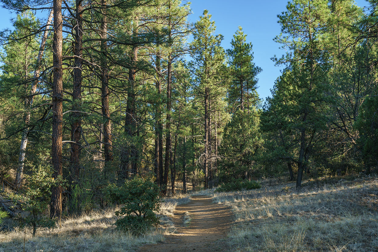
To go clockwise, go left and watch your step as the rocky track heads into the woods. The trees at this point are mostly small ponderosa pines and good-sized alligator junipers. Manzanitas are mixed in as well, along with some willows. After about 10 minutes, the rocks give way to dirt, allowing your eyes to wander. But the respite is brief as the trail gets rocky again and dips into Salida Gulch. Despite the rocky footing, the trail is easy to follow. Also, you’ll notice that the temperature is lower in the gulch — at sunrise, it can be as much as 10 degrees cooler.
After about 25 minutes, you’ll start seeing some of the large granite boulders that are so common in the Prescott National Forest. Next, the trail climbs out of the ravine and then back in again. That’s followed by a slight ascent. As you climb, you’ll come to a fiberglass trail sign. The Bradshaw Ranger District does a great job of marking its routes, although it’s not really necessary on this loop, which is well worn from hikers, horses and mountain bikers.
Continuing on, the forest thickens with some hardwoods, including oaks and walnuts, and the trail crosses the gulch. On the other side, it veers west and arrives at another gate. The hiking is especially pleasant here, but before long, the trail moves out from under the canopy and winds around to the west side of the gulch, where prickly pears make an appearance alongside the ever-present junipers.
Heading north, you’ll come to yet another gate and an intersection with the Johns Tank Trail (No. 94). The tank itself is off to the right, but the trail turns left and heads downhill for about a mile to the north end of Lynx Lake. It’s a beautiful trail that was built exclusively for hikers — bikes, horses and off-highway vehicles are not allowed.
Back on Salida Gulch, you’ll quickly come to the crest of the loop (5,805 feet) and start seeing views of the Bradshaw Mountains to the south and Granite Mountain to the northwest. As the trail descends, it re-enters the woods and begins a series of switchbacks that mark the start of the homestretch. This is the highlight of the hike. There’s nothing extraordinary about this part of the forest, but it has that subtle something that Stevenson wrote about — that emanation from old trees that so wonderfully changes and renews a weary spirit.
Therein lies the payoff.
Trail guide
Length: 4.25 miles round-trip
Difficulty: Moderate
Trailhead GPS: N 34˚32.126', W 112˚22.940'
Elevation: 5,363 to 5,805 feet
Directions: From Courthouse Square in downtown Prescott, go east on State Route 69 for 4.1 miles to Walker Road. Turn right onto Walker Road and continue 1.2 miles to Lynx Creek Road (look for the sign to Lynx Creek Ruin). Turn left onto Lynx Creek Road and continue 0.8 miles to a “Y” intersection. Bear right at the intersection and continue to the trailhead at the far end of the parking lot.
Vehicle Requirements: None
Dogs Allowed: Yes (on a leash)
Horses Allowed: Yes
USGS Maps: Prescott, Prescott Valley South
Information: Bradshaw Ranger District, 928-443-8000 or fs.usda.gov/prescott