
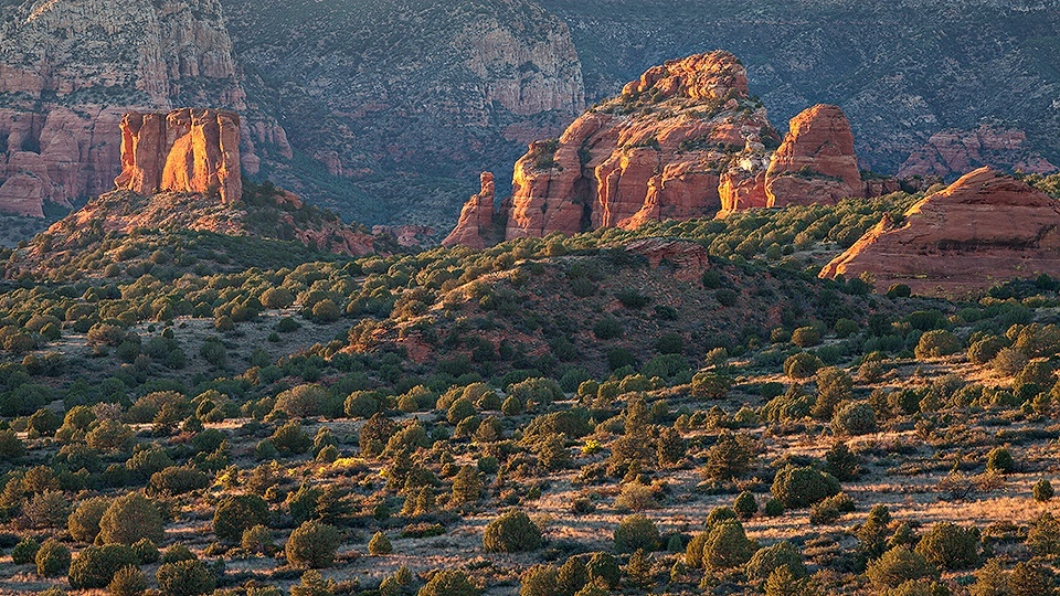
Coconino National Forest, Sedona
It’s not important for planning purposes, but the name of this trail is pronounced "doe-gi" (rhymes with hoagie). It’s a word that defines a motherless calf in a range herd. A lot of trails in Arizona get their names from ranchers or cowboys. In this case, the name comes from a demographic of cows. You probably won’t see any dogies on the trail, but you might see badgers, bobcats and mule deer. You might see hikers, too. Of the 16 established trails in the Sycamore Canyon Wilderness, this is one of the most accessible. Still, there’s a good chance you’ll be out there alone. So, pack a thinking cap, hike early and take plenty of water.
The trailhead is located at the end of a scenic road — lots of red rock and blue sky. Although a high-clearance vehicle is required, there aren’t any white-knuckle drop-offs or deadly curves. The drive is a bonus. And the hike is even better.
It begins with a quick climb to a high ridge that offers expansive views in all four directions, with virtually no signs of human existence. “Welcome to Sycamore Canyon,” Mother Nature whispers. After passing through a gate, you’ll enter the wilderness and begin a gradual descent. Piñon pines and junipers dominate the landscape early on, along with several small washes on either side.
The first ponderosa shows up about 20 minutes later. Shortly thereafter, the trail passes under (yes, under) a barbed-wire fence. To the right you’ll see Sycamore Pass Tank, more rusty fences and an old corral. As the trail continues its descent, the ground cover gets thicker. Don’t be surprised if you startle deer or kick up some grouse. The birds are a common sight in this wilderness, which provides safe haven from hunters.
Just beyond the tank, if you look to the southwest, you’ll notice a narrow passage in the canyon. At its widest point, Sycamore Canyon stretches 7 miles from rim to rim. The passage to the left, however, is measured in meters, and the rocks are measured in millions of years. Overall, the canyon’s steep sides provide a cross-section look at about 290 million years of sandstone and limestone deposits, capped by a volcanic layer of basalt.
Because this trail is well marked and easy to follow, it allows your eyes to wander and study the rock formations that have formed over time. One of them is a large mesa to the north. It’s visible from the outset, and after an hour of hiking, you’ll wind around it and see that it features a long vertical “window.” From that point, the trail gets steeper and dips into and out of a deep wash. It’s a change of pace from the rolling terrain on the upper end.
Continuing along the eastern slope, you’ll wind through a spectacular primitive campsite — it’s the only tricky spot, in terms of route-finding, but look for the cairns and you’ll be fine. From there, the ponderosas get taller and the washes get deeper. Be mindful of flash floods, especially this time of year, when monsoons can be deadly. Otherwise, look outward at the increasingly beautiful views.
Then, after almost two hours of hiking, you’ll come to a ridge that marks the final descent. The rest of the route winds through tall grasses and thorny brambles before arriving at Sycamore Creek, which is normally dry. The only perennial water is at the southern end of the canyon, where Parsons Spring feeds a 4-mile stretch (see page 28). At this crossing, the creek is lined with the canyon’s signature trees. And the bed is mostly rocks, ranging in size from cue balls to bowling balls to bigger than a bread truck.
Although the creek makes an obvious turnaround point, the Dogie Trail continues up the opposite bank for another 10 minutes to an intersection with the Sycamore Basin Trail. It’s a worthy extension. The panorama rolls across the northern skyline, and a look to the east shows the magnificent depth of the canyon. Have a hoagie and enjoy the views. Chances are, you’ll have them all to yourself. No off-road vehicles, no range herds, no little dogies.
Length: 10.8 miles round-trip
Difficulty: Strenuous
Elevation: 4,851 to 4,158 feet
Trailhead GPS: N 34˚55.359', W 111˚59.701'
Directions: From the roundabout intersection of state routes 179 and 89A in Sedona, go southwest on SR 89A for 9.7 miles to Forest Road 525 (Red Canyon Road). Turn right onto FR 525 and continue 2.7 miles to Forest Road 525C (Sycamore Pass Road). Turn left onto FR 525C and continue 8.4 miles to the trailhead.
Vehicle Requirements: A high-clearance vehicle is required.
Dogs Allowed: Yes
Horses Allowed: Yes
USGS Maps: Sycamore Basin, Loy Butte
Information: Red Rock Ranger District, 928-203-2900 or www.fs.usda.gov/coconino