
The human history of Red Rock Country stretches back much further than the late 1800s, when a handful of hardy settlers founded the community that later became Sedona. Deep in the sandstone canyons and alcoves are archaeological sites created by the area’s early inhabitants, some of whom were there at least 13,000 years ago. The two sites along Forest Road 525 aren’t quite that old, but they’re among Red Rock Country’s largest — and the view along the road is worth seeing, too.
After a short drive southwest from Sedona on State Route 89A (a scenic route in its own right), head north on FR 525, which quickly becomes a wide gravel road that’s washboarded in parts but easy to navigate overall. Straight ahead is the Red Rock-Secret Mountain Wilderness, which protects more than 48,000 acres of layered rocks and alluring canyons. Closer to the road is Windmill Mountain, a small butte you’ll curve around at Mile 2. Here, numerous prickly pear cactuses line the roadway, joining the oaks, junipers and yuccas that mark the views early on.
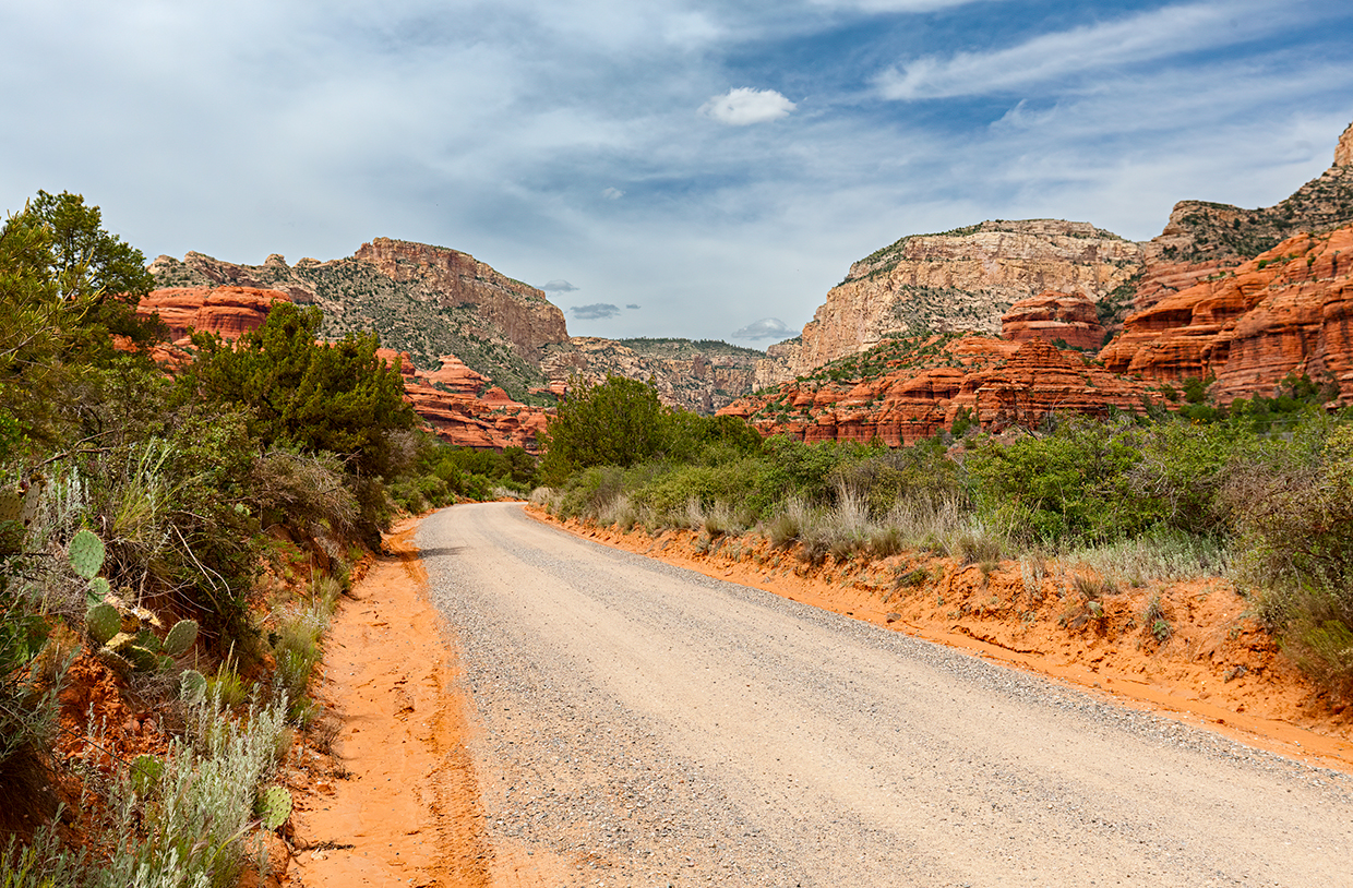
Past Windmill Mountain, the junipers get larger and more numerous, and as you crest a hill at Mile 4, the vegetation clears to reveal a panorama of the red and white rocks to the north. Two miles past that view is a “Y” intersection; the right fork leads to Palatki Heritage Site, a Sinagua cliff dwelling and rock art site built into the sandstone in the 1100s. A visit to explore the site’s numerous rooms and trails is highly recommended, but you’ll need to plan ahead — reservations are required and can be made online.
If you don’t have a reservation, bear left at the fork to stay on FR 525, which offers more incredible views of the wilderness area on the right. On the left are two flatter, darker mesas covered by junipers and scattered sandstone outcrops: Black Mountain, to the west, and Casner Mountain, to the northwest. A close approach to the red rocks at Mile 7.5 reveals the details of Red Rock Country’s sandstone, which has been sculpted by wind, rain and other natural forces over countless centuries.
From here, tall piñon pines appear among the junipers, and the road gets rougher and narrower as it dips into a wash. You’ll curve around a steep sandstone pillar at Mile 8.4 before Loy Butte comes into view a half-mile later. Named for one of Sedona’s early settlers, the large, craggy sandstone mound contrasts sharply with the greenery that surrounds it. You’ll descend into that greenery and be shaded by tall pines and junipers before curving around the Hancock Ranch at Mile 9.5. It’s less than a mile from there to the parking area for Honanki Heritage Site, this drive’s final destination.
While reservations aren’t required at Honanki, the site’s hours are limited (see Tour Guide). From the parking area, an easy loop trail of less than a mile leads to the cliff dwelling, where as many as 200 Sinagua of all ages lived in more than 70 stone rooms at the base of Loy Butte. By the early 15th century, though, the Sinagua had left the area during one of the many migrations that defined human existence in prehistoric Arizona. For a modern parallel, when you’ve seen your fill at Honanki, retrace your route back to SR 89A, on which you can migrate back to Sedona or southwest to Cottonwood and Clarkdale.
tour guide
Note: Mileages are approximate.
Length: 10.2 miles one way (from State Route 89A)
Directions: From the roundabout intersection of state routes 89A and 179 in Sedona, go southwest on SR 89A for 9.7 miles to Forest Road 525 (Loy Butte Road). Turn right (north) onto FR 525 and continue 10.2 miles to the parking area for Honanki Heritage Site.
Vehicle requirements: A high-clearance vehicle, such as an SUV or truck, is recommended, but four-wheel-drive is not necessary in good weather.
Special considerations: Honanki Heritage Site is open from 9:30 a.m. to 3 p.m. daily, while Palatki Heritage Site can be visited only with a reservation. Parking at both sites requires a $5 Red Rock Pass, which can be purchased at either site. Both sites close when the temperature is over 100 degrees or the road is impassable due to rain or snow.
Warning: Back-road travel can be hazardous, so be aware of weather and road conditions. Carry plenty of water. Don’t travel alone, and let someone know where you are going and when you plan to return.
Information: Red Rock Ranger District, 928-203-2900 or fs.usda.gov/coconino (general information); recreation.gov/ticket/facility/10089352 (Palatki reservations)
Travelers in Arizona can visit az511.gov or dial 511 to get information on road closures, construction, delays, weather and more.