
Coronado National Forest, Douglas Ranger District
On a late-July morning, my husband picks through a basket of local peaches at the Portal Store while I pore over recent bird sightings. Summer entries are sparse, but two signature species are still among them: the elegant trogon and the Mexican chickadee.
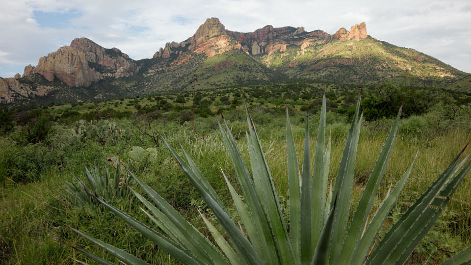
It isn’t birds we’re after, though. It’s the pleasure of a drive through one of the most beautiful and diverse parts of the state. The drive from Portal to State Route 181 in Southeastern Arizona ranges from riparian areas and high-desert grasslands to the pine and fir forests of the stunning Chiricahua Mountains, one of Arizona’s “sky islands.”
Areas along the drive burned in the Horseshoe 2 Fire of 2011, but even those appear starkly beautiful and serve as a reminder of the resilience of the state’s fire-adapted ecosystems.
The air outside feels warm and heavy. We scan the heavens for signs of rain, but the sky is clear and blue except for a single billowy thunderhead, which looks as white and benign as a drift of whipped cream.
Thus reassured, we head southwest on Forest Road 42 and drive into Cave Creek Canyon. The road soon turns to gravel as it runs along Cave Creek in the Coronado National Forest, through a tunnel of overarching oaks and sycamores. Dramatic rhyolite cliffs soar high overhead.
A little more than a mile past the Southwestern Research Station, we get our first glimpse of burned hillsides in the distance. As we get closer, the fire’s effects appear subtle. Cleared of understory, slightly darkened exposed trunks make the alligator junipers look leggy, with lush grasses carpeting the ground between them.
As the road climbs into stands of ponderosa pines, the effects are more striking, with intermittent patches of blackened trees standing in contrast to a carpet of brilliant green grass, dotted with red penstemon, purple thistle and golden butterweed. In its own way, the effect is dramatic and beautiful.
At Onion Saddle, we take a left at Forest Road 42D for a detour to Barfoot Park, along a road that feels crowded by tall, fire-damaged pines. Not far past a fire-prevention sign, its bright yellow and green contrasting against blackened trunks, Barfoot Park emerges like an oasis, with an untroubled green meadow, a profusion of penstemon blooming from concrete foundations, and a few scattered tents, small and round as the backs of turtles.
A plaque affixed to a boulder notes the park’s designation as a National Natural Landmark. Ironically, recognition of the area’s unusual mix of Sierra Madre and Rocky Mountain flora was awarded just days after the fire burned much of it.
In contrast, the popular Rustler Park Campground, 2 miles away, remains closed. But the sound of chainsaws emanating from the campground doesn’t deter the birds in the day-use area, nor the small group of birders who happily report a cordilleran flycatcher and olive and Grace’s warblers.
Back on FR 42, we descend into Pinery Canyon, the pines that inspired its name now resembling a forest of blackened toothpicks in spots, eventually giving way to oaks, junipers and grasslands dotted with century plants.
But by then, our whipped-cream cloud has given way to a dark, threatening sky. Hurrying through some major washes, we startle a deer. Soon, the national forest transitions to private pastures bordered with sunflowers. With relief, we hit the blacktop near the intersection with State Route 181, just as the first drops hit the windshield.
Note: Mileages are approximate.
Length: 24 miles one way
Directions: From Tucson, go east on Interstate 10 for 139 miles (you’ll cross the New Mexico border) to New Mexico State Road 80. Turn right (south) onto New Mexico SR 80 and continue 28 miles to Portal Road. Turn right onto Portal Road and continue 7 miles to Portal. At the fork, bear left as Portal Road becomes Forest Road 42, then continue 24 miles to State Route 181. For an optional detour, about 12 miles west of Portal, turn left onto Forest Road 42D and continue 2 miles to a fork. The left fork leads 1 mile to Rustler Park, while the right fork leads 1 mile to Barfoot Park.
Vehicle Requirements: FR 42 and FR 42D are gravel roads suitable for a two-wheel-drive passenger vehicle, although a high-clearance vehicle is recommended. Open from April through November, these roads are not plowed and are usually closed following early- or late-season snowstorms. These roads are rough and dusty and might be muddy and slick after a rain.
Information: Douglas Ranger District, 520-364-3468 or www.fs.usda.gov/coronado
Travelers in Arizona can visit www.az511.gov or dial 511 to get information on road closures, construction, delays, weather and more.