Prescott National Forest, Cottonwood
You won’t touch any summits or conquer any canyons on this hike, but you’ll earn a notch in your belt nonetheless. There are longer hikes and more difficult trails, but the challenge here is staying the course. Although the Chino Valley Ranger District does a great job of marking the route with cairns, Packard Mesa is crisscrossed by several cattle paths, which look identical to the trail you’ll be hiking, and it’s covered with a blanket of thorny brambles and long grasses. That adds up to a trail that’s hard to follow, which is why this month’s Hike of the Month comes with a powerful disclaimer: Unless you have excellent route-finding skills, you might want to sit this one out. However, if you can read a compass and you’re up for a challenge, this is a great hike.
The adventure begins at the southern end of Sycamore Canyon. For the first five minutes, you’ll follow the Parsons Trail down a steep slope to the bank of Sycamore Creek, which runs year-round and separates the Coconino National Forest from the Prescott National Forest. The creek is the first test. Although there’s a wooden sign to point you in the right direction, it’s difficult to see exactly where to cross the creek. There are cairns, if you can find them. If not, just rock-hop across the water and bushwhack to the opposite bank. Initially, the trail parallels an old barbed-wire fence. When you find it, veer left and begin the long, grueling climb to Packard Mesa.
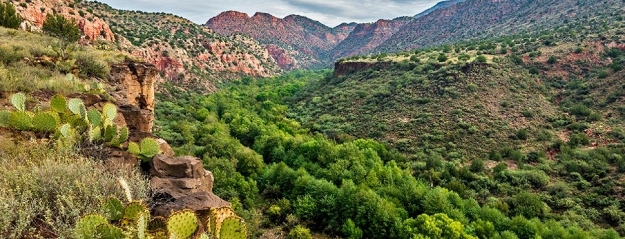
Within a few hundred yards, you’ll arrive at the boundary of the Sycamore Canyon Wilderness. From there, there are two things you’ll need to look for: prickly pears and cairns. You already know about the importance of the cairns. The cactuses are singled out for their gargantuan nature and their menacing barbs. They’re hell-bent on getting you. That’s why gaiters are a good idea.
About 20 minutes in, you’ll come to another wooden sign marked simply “66.” That’s the official trail number, and you’ll need to know it later on. At this point, though, you need to focus on drinking a lot of water and keeping a steady pace. Ten minutes beyond the sign, you’ll leave the wilderness area and make your way to a shelf that masquerades as the top. It’s not. It’s a pawn of Mother Nature, put there to deter the less determined. Take a breather, and then continue the climb. As you huff and puff uphill, you’ll pass a massive boulder and another “66” sign, after which you’ll veer left along a large wash littered with big rocks and several broken trees.
The route along the wash lasts about 10 minutes and leads to the top. It’s a long haul, but the payoff is a gorgeous high-chaparral grassland dotted with ancient junipers and galloping jackrabbits — some of the hares are so big you’ll think you’re hallucinating. The views are nice, too, especially Sycamore Canyon to the east and Kendrick Peak to the north.
From there, the trail is mostly level as it heads north and parallels the western edge of the wilderness area. Press firmly with each step — your footprints will come in handy on the return trip — and keep your eyes peeled for the indispensable cairns. At the two-hour mark, you’ll see another “66” sign before entering a flat area of red dirt that floods when it rains. The water has created some deep ruts that obscure the trail, but if you pay attention, you’ll eventually arrive at an intersection with the Sycamore Basin Trail, which is marked as “63” — it comes in from the west and then heads north.
Technically, this is where the Packard Mesa Trail ends, but most hikers continue north on “63” to the edge of Sycamore Canyon. To get there, you’ll pass through two gates on either side of Sycamore Tank and come to another “63” sign along a narrow jeep road. The trail here is extremely difficult to find, but if you scan the tall grass along the road and look due north, you’ll find it. Ten minutes later, you’ll arrive at the edge of Sycamore Canyon and the boundary of the wilderness area. If you make it this far, give yourself a pat on the back. However, if you want a notch in your belt, you’ll have to make it all the way back.
Length: 11.8 miles round-trip
Difficulty: Strenuous
Elevation: 3,775 to 4,810 feet
Trailhead GPS: N 34˚51.837', W 112˚04.143'
Directions: From Cottonwood, go northwest on Main Street and follow the signs to Tuzigoot National Monument. Turn right onto Tuzigoot Road, continue across the Verde River bridge and turn left onto Forest Road 131 (Sycamore Canyon Road). From there, it’s 11 miles to the trailhead.
Vehicle Requirements: A high-clearance vehicle is required.
Dogs Allowed: Yes
Horses Allowed: Yes
USGS Maps: Sycamore Basin, Clarkdale
Information: Chino Valley Ranger District, 928-777-2200 or www.fs.usda.gov/prescott

