
Most visitors to Mingus Mountain, one of Central Arizona’s best-known landmarks, travel a paved, winding road from State Route 89A to the top of the mountain. But if you’ve got a four-wheel-drive vehicle and you’re looking for a challenge, consider taking the alternative route: a series of county and forest roads leading north from State Route 169. What this true back-road adventure lacks in easy driving, it makes up for in scenery and solitude.
The adventure begins on Cherry Creek Road, a paved route that rolls through low hills, chaparral vegetation and weathered granite formations on its way to the former mining town of Cherry. Just before you get to town, you’ll turn left onto Forest Road 132, a dirt road that’s somewhat rutted but otherwise fairly smooth in the early going. After a mile or so, you’ll descend into a more forested area before reaching a “Y” intersection; bear left to stay on FR 132, which narrows and winds past large alligator junipers and a handful of ponderosa pines.
A half-mile past the intersection, on the left, you’ll pass a hillside covered with ponderosas and a large, squarish rock balanced on a pedestal. Pines, junipers and oaks then close in on the road before a climb opens up the view. You’ll get an excellent look at the surrounding Black Hills, which have an extensive mining history and today are home to three wilderness areas.
By now, you’ll probably have noticed that the road has gotten rougher. That trend intensifies around Mile 8, with rocks and deep ruts defining a long stretch of the roadway. But the views on both sides compensate the effort. The road next climbs again as it winds around the west side of Goat Peak, offering a nice view to the southeast. As the views get better, the road gets worse, and you’ll find yourself crawling along. That’ll continue until you get off FR 132, so take your time and enjoy the scenery.
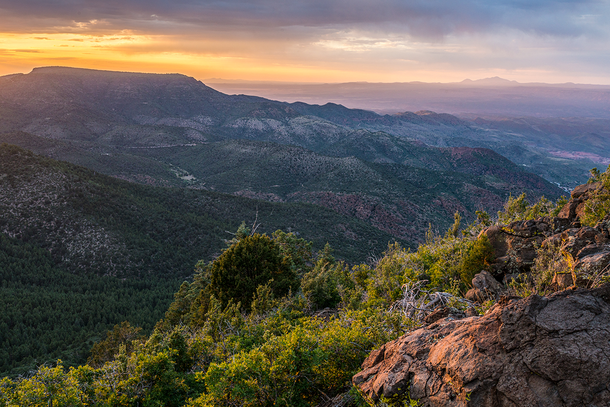
At Mile 11.4, on the left, is the best view of the drive so far: the Black Hills spread out beneath you, with tall ponderosas thriving on hillsides. From here, the road alternates between thick forests (pines, junipers and agaves) and long views. Past a short section of private land at Mile 13, you’ll descend into another wooded area before reaching a “T” intersection. To the left is Forest Road 105, but you’ll turn right to stay on FR 132 and continue less than a half-mile to where the road becomes Forest Road 413, which is bumpy but smoother than the one you just endured. More pines and junipers line this road as it climbs toward the summit of Mingus Mountain, and around Mile 17, you’ll get a fleeting glimpse of the Prescott area’s Granite Mountain on the left.
Once you reach another “T” intersection, this one with Forest Road 104, you’ll know you’re almost there. This is the main route up the mountain, and turning right and traveling 1 mile farther will take you to Mingus Mountain Recreation Area. Up here, you’ll find campgrounds, picnic sites, a hang glider launch site, overlooks of the Verde Valley and a small lake that’s periodically stocked with rainbow trout. There also are numerous hiking trails, and a side road, Forest Road 104B, leads to the mountain’s fire lookout. And when you’ve had all the excitement you can handle for the day, you can head down the easy way — unless you’re up for another challenge on the back roads.
tour guide
Note: Mileages are approximate.
Length: 20 miles one way (from State Route 169)
Directions: From the intersection of Interstate 17 and State Route 169, go west on SR 169 for 5.4 miles to Cherry Creek Road (County Road 75). Turn right (north) onto Cherry Creek Road and continue 5.1 miles to Forest Road 132. Turn left onto FR 132 and continue 11.3 miles to a “T” intersection. Turn right to stay on FR 132, which soon becomes Forest Road 413, and continue 2.6 miles to Forest Road 104. Turn right onto FR 104 and continue 1 mile to Mingus Mountain Recreation Area.
Vehicle requirements: A high-clearance, four-wheel-drive vehicle, such as an SUV or truck, is required.
Special consideration: The Prescott National Forest charges a $5 fee at developed day-use sites atop Mingus Mountain. Campgrounds require additional fees.
Warning: Back-road travel can be hazardous, so be aware of weather and road conditions. Carry plenty of water. Don’t travel alone, and let someone know where you are going and when you plan to return.
Information: Verde Ranger District, 928-567-4121 or fs.usda.gov/prescott
Travelers in Arizona can visit az511.gov or dial 511 to get information on road closures, construction, delays, weather and more.