
White Mountains, Apache-Sitgreaves National Forests
''Killer hike" is how you'd describe Los Burros if you were writing a postcard. Even the historic red barn, which greets hikers at the trailhead, is alluring. Or maybe "mystical" is a better word. It's the kind of place Django Reinhardt might have hunkered down with a bottle of Château Margaux, despite the "no trespassing" sign.
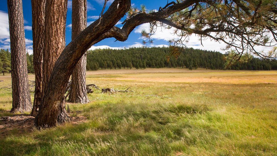
From the trailhead, a wide, needle-covered path crosses a beautiful meadow and quickly arrives at a gate that parallels a forest road. It's the first of many forest roads you'll cross. Don't worry about their FR numbers. Instead, focus on the blue-diamond trail tags that identify this hike as part of the White Mountains Trail System. Although the route is obvious in most places, the markers come in handy — there are a lot of right- and left-hand turns on this long and winding trail, which ultimately wraps around Wishbone Mountain.
Beyond the gate, the trail begins a gradual uphill climb through a forest of oaks, aspens and ponderosas. The pines are being thinned out and loaded onto diesel trucks. It's something you'll see, on and off, on this trek. Twenty minutes later, you'll arrive at a signed junction that'll make you wonder where to go. For an abbreviated loop, go straight, but to get the most mileage out of Los Burros, go left and keep your eyes peeled for the blue diamonds. More trees, more meadows and more evidence of logging will hold your attention as you continue. Then, after another 20 minutes, you'll come to a grassy hillside and a stock tank, followed by a couple of 90-degree turns and an intersection with another forest road.
From there, the route meanders through the woods, and the scene stays about the same until the single-track trail transitions into a two-lane jeep road that follows the ridge of a small canyon. Ferns, firs, spruce and aspens make this stretch the best stretch of the day. The boreal forest is lush, and it's the most likely place to see black bears. Even if you don't, you will see their claw marks on the aspens.
That show lasts for about a half-hour. It's beautiful, and the denouement is a long downhill run. Appreciate the benefits of gravity — it's not just a good idea; it's the law. At the bottom of the hill, the trail arrives at a cluster of buildings. Just beyond them, it crosses yet another forest road and skirts a meadow that's fenced off as a "Wildlife Forage Monitoring Area." Back in the woods, you might hear a few of the resident Steller's jays. They're loud and outspoken — editorializing, perhaps, about the extensive logging in the area. You might also see some of the mule deer and elk that are being kept out of the segregated meadow behind you.
Oaks and ferns dominate the landscape for the next mile, which leads to an intersection with the Lake Mountain Spur — a route that climbs to the Lake Mountain Lookout Tower, which was added to the National Register of Historic Places in 1988. Veer left for Los Burros, and continue to the crest of a ridge that offers some long views to the southwest. Ten minutes later, you'll arrive at an open area that features a secondary trailhead for Los Burros. It's a good place to do a dance in the sun. From there, the trail crosses a big meadow, passes a few more piles of logs and eventually arrives at a power-line road. Turn right, hike beneath the electricity for about 100 yards and turn left into the woods. It's a quick trip from there to the old red barn. If you have the luxury of time, snag one of the 10 campsites at the trailhead, unfold a folding chair, pour a glass of Château Margaux and fill out a few postcards. This killer hike is worth writing home about.
Length: 13.8-mile loop
Difficulty: Moderate
Elevation: 7,838 to 8,370 feet
Trailhead GPS: N 34˚08.359', W 109˚46.631'
Directions: From Pinetop-Lakeside, drive east on State Route 260 for 5.2 miles to Cady Avenue. Turn left onto Cady Avenue, which becomes Forest Road 224, and continue for 7.1 miles to Forest Road 20 (look for the Los Burros Campground sign). Turn right onto FR 20 and continue 0.5 miles to the trailhead, which is located at the far end of the campground.
Vehicle Requirements: None
Dogs Allowed: Yes (on a leash)
Horses Allowed: Yes
USGS Maps: Sponseller Mountain, Boundary Butte
Information: Lakeside Ranger District, 928-368-2100 or www.fs.usda.gov/asnf