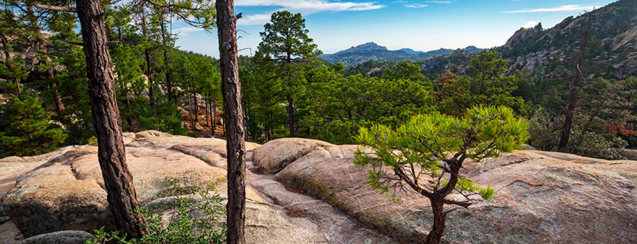
Santa Catalina Mountains, Coronado National Forest
It shouldn’t be easy to get to a place called the “Wilderness of Rock” — or anywhere in the backcountry. It should take some effort, like learning to speak German or skinning at Arapahoe Basin. In 1951, Arizona Highways Editor Raymond Carlson described the remote areas like this: “The surfaced roads go on and on and then they stop. Gravel roads take up where the surfaced roads end and they, too, go on and on. Finally, there are only wagon tracks or aimless trails. When you can’t go any further, just look around: You are in the backcountry.”
He might have been depicting the Wilderness of Rock. To get there, you have to drive until you run out of road, and then you have to hike an overture just to get to the point where this trail begins. None of that is a hardship, however. The Catalina Highway is a National Scenic Byway. And the Aspen Trail is a jewel in just about any crown. The only downside, if there is one, is the extra time it adds to the overall adventure. The upside is that it thins the crowd and keeps the wilderness from looking like Fossil Creek.
The hike begins at the Marshall Gulch Picnic Area, which serves as the trailhead for the Marshall Gulch Trail and the Aspen Trail. Both routes lead to the Wilderness of Rock Trail. Take your pick. It’s like choosing fries or onion rings. There’s decadence either way.
For the Aspen Trail, look for a sign marked “93” to the left of the restroom. From there, the trail climbs through a forest of ponderosa pines, Douglas firs and Gambel oaks. A few minutes later, it levels off and cuts through a thick grove of young aspens. They’re among the many signs of life in the wake of the Aspen Fire, which clobbered the mountaintop in 2003. You’ll see signs of the fire, too, but, for the most part, this route sidesteps the worst reminders. The track here is well worn and easy to follow. That won’t always be the case.
About 10 minutes in, the trail crosses into the Pusch Ridge Wilderness, which was established in 1978 and now protects 56,974 acres. Its preservation history, however, dates to 1927, when the Santa Catalina Research Natural Area was established — it was the first place in the U.S. to be designated as such.
From the boundary, the trail starts climbing again through a series of long switchbacks to an elevation of 8,101 feet, which is the high point of the two trails. The rest of the route is mostly downhill, but there’s a lot of up and down along the way. And by the time you get back to the picnic area, you’ll have climbed more than 2,000 feet — add another 500 if you parked at the Forest Service gate.
As you start down, you’ll wind around a deep side canyon and pass through a tunnel of young ponderosas. Then, after an hour of overall hiking, you’ll come to an intersection with three trails: Marshall Gulch (#3), Mint Spring (#20) and Wilderness of Rock (#44). Everything up to this point has been a warmup. This is where the show begins. And it begins with a steep descent on a rocky slope that would be hard to follow without so many well-placed cairns. They’re there, in part, because this route overlaps Passage 12 (Oracle Ridge) of the Arizona Trail. There’s a lot of foot traffic.
Continuing on, the rocks give way to pine needles, the forest thickens, and the trail crosses a creek before coming to an intersection with the Lemmon Rock Trail. Just beyond the crossroad is an old-growth ponderosa that stands out like Deacon Jones at an Easter egg hunt. Then, about 15 minutes later, the trail arrives at a ridge that overlooks the Wilderness of Rock. It’s gorgeous.
If you’re looking for a shorter trek, this is a good place to turn around. If you want to go the distance, and hike through the weathered hoodoos, you’ll have to pay close attention to the cairns, especially where the trail dips into some of the washes. Also, the trail gets more technical as it shifts uphill along a steep, rocky bank and makes a final push to its denouement at the Mount Lemmon Trail. If you make it that far, smile, catch your breath and take a bow. Like Deutsch lernen, you’ll have earned it.
Length: 13 miles round-trip (via the Aspen Trail)
Difficulty: Strenuous
Elevation: 7,110 to 8,101 feet
Trailhead GPS: N 32˚25.689', W 110˚45.335'
Directions: From the fee station (permanently closed) on the Catalina Highway, go northeast for 20.6 miles to Forest Road 10. Veer left onto FR 10 and continue 0.5 miles to the Marshall Gulch Trailhead. (Note: The Forest Service closes FR 10 in the winter. If the gate is closed, park at the gate and walk to the trailhead.)
Special Consideration: A $5 day pass is required.
Vehicle Requirements: None
Dogs Allowed: Yes
Horses Allowed: Not suitable for horses.
USGS Map: Mount Lemmon
Information: Santa Catalina Ranger District, 520-749-8700 or www.fs.usda.gov/coronado

