
Kaibab National Forest, Williams
Sycamore Canyon is Arizona’s second-largest gorge — second only to the natural wonder that can be seen from outer space. The attributes of the Grand Canyon are many, but the state’s runner-up has a few of its own, including the 13-mile drive to reach it. It’s a picturesque route through the Kaibab National Forest that gets less traffic than a Sonoran Desert highway in the dead of summer.
The drive begins on Garland Prairie Road, which intersects with Interstate 40 just east of Williams. After crossing a set of train tracks, stay left until you merge onto a well-maintained dirt road and head into the first of several thick stands of ponderosa pines.
A few miles in, you’ll come to another fork. Turn left and continue to McDougal Flat, a large clearing that offers a nice view of the San Francisco Peaks on the left. From there, it’s back into the ponderosas, where you’ll see signs directing you toward the Sycamore Canyon Vista trailhead.
Following the signs, you’ll end up on Forest Road 56, another good dirt road. It narrows to one lane in places and gets a little rough in others. Mind your speed, roll down the windows and enjoy the sights and sounds of the high country. At Mile 11, you’ll come to a turnoff that leads to the Sycamore Rim Trail, but that’s a hike for another day. Keep going straight until FR 56 dead-ends at the trailhead.
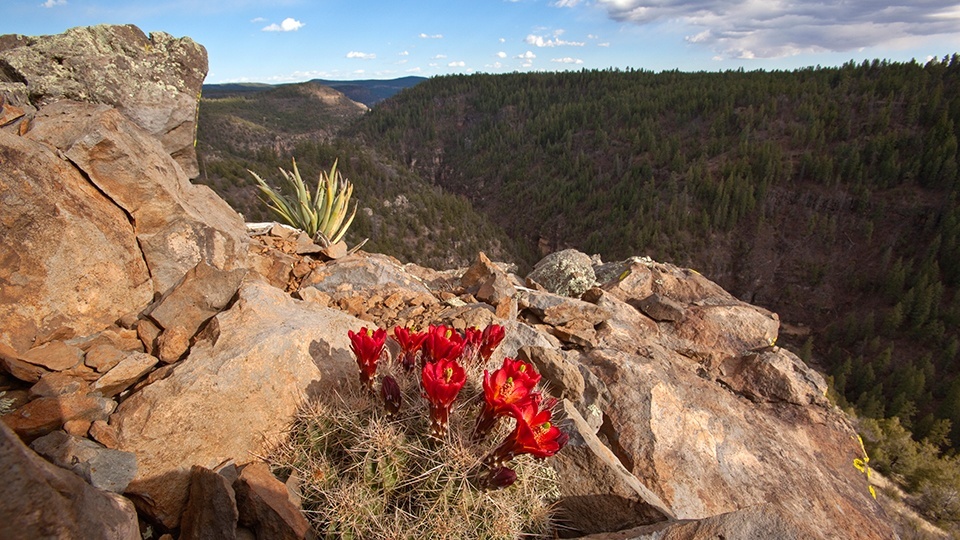
A map of the canyon’s entire trail system is posted there. Many of the hikes are long, but the trail to Sycamore Canyon Vista is only a quarter-mile. From the viewpoint, you’ll get a good look at Arizona’s second-largest canyon, as well as a glimpse of Sycamore Creek on the canyon floor.
Because the 21-mile-long canyon is a protected wilderness area, there aren’t any roads or campgrounds within it — just the canyon’s namesake sycamores, along with ponderosas and other evergreens. If you move quietly, you might see deer or elk at the vista, as well as lizards and birds. Enjoy the view. It’s not the Grand Canyon, but, as you’ll see, that won’t matter.
Note: Mileages are approximate.
Length: 13 miles one way
Directions: From Flagstaff, go west on Interstate 40 for 28 miles to Exit 167 (Garland Prairie Road). Turn left onto Garland Prairie Road, which later becomes Forest Road 141, and continue 9 miles to Forest Road 56. Turn right onto FR 56 and continue 4 miles to the Sycamore Canyon Vista trailhead.
Vehicle requirements: None; however, a high-clearance vehicle is recommended in inclement weather.
Warning: Back-road travel can be hazardous, so be aware of weather and road conditions. Carry plenty of water. Don’t travel alone, and let someone know where you are going and when you plan to return.
Information: Williams Ranger District, 928-635-5600 or www.fs.usda.gov/kaibab