
Coronado National Forest, Safford
Sometimes, big things really do come in small packages. And big scenery often comes on little roads. State Route 266 is one of the shortest state highways in Arizona — with just under 20 miles of pavement cutting across the rugged rangeland south of Safford — but every mile dishes up dramatic vistas as the road rambles westward along the fringe of the Pinaleño Mountains, making this quick journey a big one for memories.
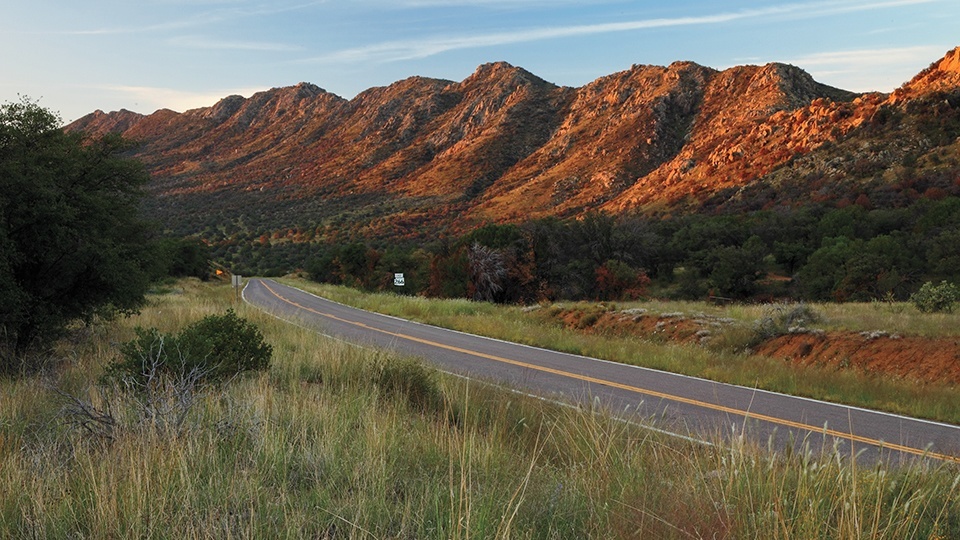
The Pinaleños are sudden mountains, an abrupt and brutish thrust. They rise in a cloud-piercing hulk from the desert floor with more than 7,000 feet of vertical relief — more than any other mountain range in the state. Yet SR 266 doesn’t venture into the higher reaches like some tortuous switchbacking mountain roads in Arizona. Instead, it rambles across the broad flanks of the hills in a relaxed and easy drive of swooping curves and gentle terrain.
About halfway in, the road climbs over Stockton Pass at 5,600 feet and drops into the Sulphur Springs Valley. It then passes through a jumbled cluster of boulders and enters the Coronado National Forest. Ocotillos march up the slopes, limbs raised in a sort of spindly celebration. After crossing Gillespie Wash, you’ll begin seeing the scars of a lightning-sparked fire that burned in 2012. The blaze turned out to be a fortuitous one, as it struck an area slated for a prescribed burn. Overgrown chaparral was cleaned out, and the big cottonwoods and sycamores canopying the wash were spared. Good monsoon rains rolled in on the heels of the fire, and the restoration of native grasslands is well underway.
The views at this point include the Galiuro Mountains as the road descends through the grassy savanna and past the turnoff to Fort Grant State Prison. As you approach the small ranching outpost of Bonita, a few cottonwoods crowd in. The pavement ends at Bonita, in front of the shell of the old country store, which was built in 1882.
It’s the end of the pavement, and the end of SR 266, but a dirt road continues, stretching across the valley. Those with a real taste for adventure can keep driving to the eastern entrance to Aravaipa Canyon, a perennial stream that’s carved out a trough up to 1,000 feet deep in the Galiuro Mountains. Be sure to check road conditions before attempting. Otherwise, it’s a short but scenic drive back to the main highway.
Note: Mileages are approximate.
Length: 20 miles one way
Directions: From Safford, drive 17 miles south on U.S. Route 191 to State Route 266 and turn right.
Vehicle Requirements: None
Warning: Back-road travel can be hazardous, so be aware of weather and road conditions. Carry plenty of water. Don’t travel alone, and let someone know where you are going and when you plan to return.
Travel Advisory: A permit is required to hike or camp in Aravaipa Canyon. Only a limited number are issued each day, so plan ahead. For more information, contact the Bureau of Land Management at 928-348-4400.
Information: Safford Ranger District, 928-428-4150 or www.fs.usda.gov/coronado