
Hualapai Valley, Northwestern Arizona
Listen, birds, these signs cost money. So roost awhile, but don’t get funny.
Burma-Shave and Route 66 were made for each other. The shaving cream brand came into existence in 1925, just a year before the Mother Road, which ran from Chicago to Los Angeles, made its debut. And Burma-Shave became known as a source of humorously poetic signage along Route 66 and other American highways. Burma-Shave is long gone, but you’ll see re-creations of its iconic signs along Historic Route 66 between Seligman and Kingman. You’ll see sprawling valleys, striking mountain ranges and diverse wildlife, too.
The drive begins at Delgadillo’s Snow-Cap Drive-In, an iconic lunch spot once described as being “built with scrap lumber and held together with kitsch.” From there, head west on State Route 66, the only section of the Mother Road in Arizona that has a state route designation. It’s a two-lane road, so stay alert and heed the Burma-Shave signs: If daisies are your favorite flower, keep pushing up those miles per hour.
Once you’re out of town, you’ll pass Chino Point and enter broad, flat Aubrey Valley, home to a reintroduced population of endangered black-footed ferrets. You might not see a ferret — they’re nocturnal — but don’t be surprised to see an American badger, which preys on ferrets, barreling across the road. Birds of prey, such as golden eagles, ferruginous hawks and burrowing owls, can also be spotted in the area.
On the way out of the valley, you’ll reach Grand Canyon Caverns, which bills itself as the largest dry caverns in the U.S. An elevator takes visitors 200 feet below ground for tours of the caves, which are about 65 million years old. From this point on the route, you might be able to make out the cliffs of the Grand Canyon to the north.
Next, the road curves to the southwest and enters Peach Springs, a Hualapai Tribe community that offers views of Laughing Jack Butte (6,158 feet) and the Music Mountains to the west. The tiny towns of Truxton, Valentine and Hackberry are farther west. Valentine is home to a shuttered Indian school that operated in the early 20th century, and in Hackberry, you can grab a cold drink and a Route 66 souvenir at the popular Hackberry General Store.
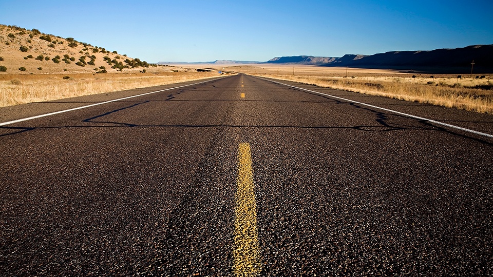
The final stretch features some of the route’s best views as it descends into the Hualapai Valley. To the northeast are the dramatic Grand Wash Cliffs; the rocky Cerbat Mountains rise in the west. Soon, you’ll be in Kingman, the stopping point for this drive. Of course, for a different perspective, you could turn around and head back to Seligman the way you came. But take your time. In fact, take it from Burma-Shave: You can drive a mile a minute. But there is no future in it.
Note: Mileages are approximate.
Length: 83 miles one way
Directions: From Delgadillo’s Snow-Cap Drive-In in Seligman, go west on Historic Route 66 (also designated State Route 66) for 83 miles to Kingman.
Vehicle requirements: None
Information: Arizona Scenic Roads, www.myscenicdrives.com/regions/arizona; Grand Canyon Caverns, 928-923-6664 or www.gccaverns.com