
EDITOR'S NOTE: Readers have reported that road conditions on this route have deteriorated since this story was published. A high-clearance, four-wheel-drive vehicle, such as an SUV or truck, is required, and all-terrain tires are strongly recommended.
The routes to Crown King are as numerous as the mines that once dotted the Bradshaw Mountains, where the popular tourist destination is located. The 37-mile drive from Prescott along Senator Highway is one of the nicest. It begins and ends in ponderosa pine forest and takes in a little of everything in between — from mixed-conifer forests with bigtooth maples and Gambel oaks to high-desert chaparral — all rich with history. It’s a beautiful, half-day drive on a road that becomes narrow, rutted and slow-going in spots, making it popular with ATVs and dirt bikes.
From Gurley Street, we head south on Mount Vernon Avenue, one of the oldest streets in Prescott. Here, mature elms shade well-tended lawns and fine examples of Craftsman bungalows and Victorian homes, which document the evolving tastes of the Territorial capital.
In a half-mile, the road becomes Senator Highway, named for the Senator Mine. The oldest section was built in 1866 as a toll road. It was extended to the Senator Mine in 1875, then to Crown King, bit by bit, over the following decade.
The first few miles are paved, passing Goldwater Lake — a small kayaking lake and city park — and the small community of Groom Creek, named for Robert Groom. The Army colonel from Kentucky surveyed the first Prescott town site and prospected this area in the 1860s.
At about 6 miles, we reach the turnoff for the Groom Creek Schoolhouse. Now owned by the U.S. Forest Service, the historic two-room stone building served as a school until the 1950s. The day-use area includes a picnic area and a paved interpretive trail.
Past Groom Creek, the pavement ends. On the right side of the road, we watch for the remains of Maxton, where the Senator Mine was located. We spot a steel skeleton and concrete base at Mile 10.
Operating off and on from 1865 to the 1930s, the mine was one of the longest-running operations in the Bradshaws. The men who staked the claim included Territorial Governor John Goodwin and Secretary Richard McCormick, who later became governor. The mine’s name may have stemmed from the men’s ambitions for Arizona statehood and ascension to the U.S. Senate.
After crossing the Hassayampa River, just a creek here, the road narrows, becoming rough enough to slow us down to 10 to 15 mph, but we don’t mind. It’s a beautiful stretch, with ponderosa pines mixing with Douglas firs and Gambel oaks.
We nearly miss the turn onto Forest Road 52, marked only by a post on which someone has written “C. King” and an arrow to the right. As the road descends, beautiful vistas open up: distant mountains falling away in layers, the light filtering through backlit oaks and bigtooth maples.
A little more than halfway, we come to Palace Station, a hand-hewn log building that served as a stage stop until 1910. Continuing on, Gambel oaks give way to evergreen oaks and, ultimately, desert scrub oaks. But up ahead, we see the ponderosa pine forest that shelters our destination.
Once the road again begins to climb, we move quickly back into the pines. We pass the site of Bradshaw City — named for William Bradshaw, who discovered minerals in these mountains in the mid-1860s — before arriving at Crown King.
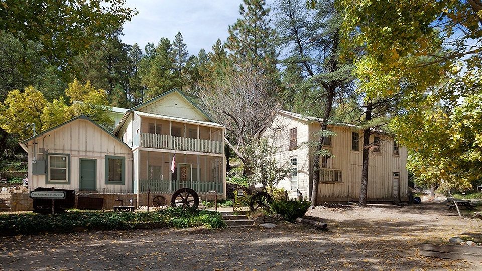
Named for the Crowned King Mine, the community once was a booming mining town with a railroad and several saloons. Today, it’s home to about 100 full-time residents, along with cabin rentals, a historic saloon-hotel and a general store. Return the same way, or take the gentler route through Bumble Bee to Interstate 17.
Note: Mileages are approximate.
Length: 37 miles one way
Directions: From the intersection of Gurley Street and Mount Vernon Avenue in Prescott, go south on Mount Vernon Avenue, which becomes Senator Highway (Forest Road 56), for 12.5 miles to Forest Road 52. Turn right onto FR 52 and continue 24.5 miles to Crown King.
Vehicle requirements: A high-clearance, four-wheel-drive vehicle, such as an SUV or truck, is required. Don’t attempt the drive in wet weather.
Warning: Back-road travel can be hazardous, so be aware of weather and road conditions. Carry plenty of water. Don’t travel alone, and let someone know where you are going and when you plan to return.
Information: Bradshaw Ranger District, 928-443-8000 or www.fs.usda.gov/prescott