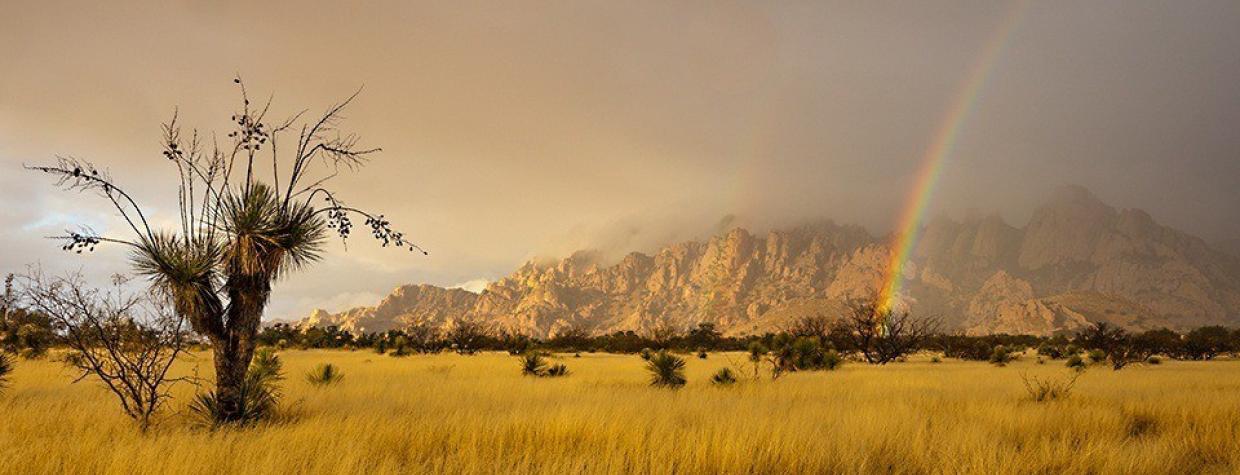
Dragoon Mountains, Tombstone
The O.K. Corral. The Bird Cage Theatre. Gunfight re-enactments. When it comes to Wild West history, Tombstone has plenty to offer, which is why the town of 1,500 or so permanent residents sees hundreds of thousands of visitors every year. Just outside “The Town Too Tough to Die,” though, is Middlemarch Road, a spectacularly scenic route through the Dragoon Mountains. And, as a bonus, the road has a history of its own.
Reset your odometer in Tombstone, then head northwest on State Route 80 and turn right onto Middlemarch Road, which once formed part of an Army route between Fort Bowie, now a national historic site to the northeast, and the San Pedro Valley to the southwest. After several miles on the wide, well-maintained dirt road, you’ll approach the Dragoons — named, according to the book Arizona Place Names, for a cavalry regiment that manned several posts in the area in the mid-1800s. The mountains are best known for Cochise Stronghold, where the Apache chief holed up while battling the U.S. military. He later was buried there, although the exact location of his grave was known only by people who took it to … well, their graves.
You won’t find Cochise, but you can explore the formations to the north by turning left onto Forest Road 687 at Mile 10. For this drive, though, stay on Middlemarch Road as it winds its way into the mountains. The desert vegetation you saw earlier in the drive soon gives way to more greenery, including piñon pines, junipers and a variety of oaks. Keep an eye out for mule deer and white-tailed deer, along with jackrabbits and various raptors. The route gets rougher and narrower as it climbs, so keep an eye on the road, too.
Before long, you’ll reach Middlemarch Pass and be treated to the best view of the drive: the unmistakable Chiricahua Mountains to the east. To their southwest are the smaller Swisshelm Mountains, named for a prospector who explored the area in the 1870s. There are expansive views at Soren Pass, accessible via a 3-mile side trip north on Forest Road 345A, but you’ll need a four-wheel-drive vehicle. If you don’t have one, just enjoy the gradual descent toward Pearce, which features more nice views of the distant mountain ranges.
A road sign notes that Pearce boasted 1,500 residents in 1920, and several buildings remain from the heyday of this gold-mining boomtown. A right turn onto Pearce Road will take you to U.S. Route 191, which leads north to Interstate 10 and south to McNeal and Douglas. But if you’d like to make this a loop drive, go south on U.S. 191, turn right onto Gleeson Road and take that road back to Tombstone. Chances are, you’ll arrive just in time for another gunfight.
Note: Mileages are approximate.
Length: 26.6 miles one way (from Tombstone)
Directions: From Tombstone, go northwest on State Route 80 for 1.6 miles to Middlemarch Road (Forest Road 345). Turn right (east) onto Middlemarch Road and continue 20.5 miles to Pearce Road. Turn right onto Pearce Road and continue 4.5 miles to U.S. Route 191.
Vehicle requirements: A high-clearance vehicle is recommended, but four-wheel-drive is not necessary in good weather.
Warning: Back-road travel can be hazardous, so be aware of weather and road conditions. Carry plenty of water. Don’t travel alone, and let someone know where you are going and when you plan to return.
Information: Douglas Ranger District, 520-364-3468 or www.fs.usda.gov/coronado

