
Coronado National Forest, Santa Catalina Ranger District
Tucson is one big city — not as big as Phoenix and nowhere near as big as L.A., but big enough. That’s why it’s so surprising that Mescal Road, a nearly 16-mile stretch of scenic byway, is so close to the city limits. Literally, it’s just over the creek and through the woods.
The drive begins on Mescal Road, about 40 miles east of Tucson, off of Interstate 10 at Exit 297, and meanders past a few small private properties before opening onto fields of yucca and fragrant creosote. After approximately 2 miles, the paved road crosses a set of railroad tracks, then becomes rockier as it approaches an Old West town after another mile. It’s not a real town, just a replica that Old Tucson Studios used as a set for the last few episodes of Bonanza and for movies such as The Quick and the Dead. Although the set is closed to the public and visitors are forbidden from approaching for a closer look, it’s easy to use your imagination and picture gunfights and sarsaparilla-slinging.
Beyond the movie set, the pavement ends, but the road is still passable in a standard-clearance vehicle. As it continues, the creosote thins to make way for thick stands of wild grasses, particularly as the road becomes hillier at approximately 4.7 miles. Later, cottonwoods, sycamores and manzanitas will become visual staples. Five miles in, you’ll encounter your first water crossing — one of many, as the road traverses both Ash and Paige creeks. Here, the city seems more distant than it is, and the road continues past a cattle pen — where the cows are more than happy to oblige a photo opportunity with moos and cud-chewing — and Ash Canyon Ranch.
Past the ranch, the road is at its rockiest and, in fact, its steepest. It tops out at Mile 7 and becomes smooth again. After another mile, it’s possible to pull into a rustic campsite, where a downed tree provides the perfect perch for a picnic. Sadly, you might discover the remnants of someone else’s party, as some visitors find this an appropriate place to bid farewell to their garbage. On a happier note, you might also happen upon a horse that’s wandered from the nearby B&D Ranch. Or maybe some deer.
Just beyond the halfway point, it’s possible to be in two places at one time. At nearly 9 miles down the road, you’ll straddle the line between Cochise and Pima counties, where stands of ocotillos appear along the roadside like cryptic fingers emerging from the boulder-strewn soil. From there, the road becomes — in parts — patchy and occasionally turbulent, but remains passable.
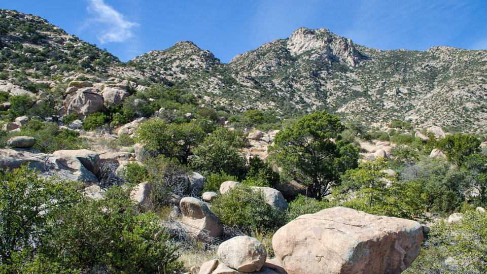
After another 3 miles, the road once again climbs, this time up a hill that provides a spectacular view of the Little Rincon and Galiuro mountains, as well as Happy Valley. At the bottom of the hill, the road cuts through a grassy pasture and past several ranch properties. One-tenth of a mile beyond the pasture, you’ll see a sign for the Miller Creek Trailhead. The path, which is part of the Arizona Trail, winds to the edge of Saguaro National Park. There, the road ends, but another great picnic spot lies just a few hundred feet from the trailhead.
Note: Mileages are approximate.
Length: 16 miles one way (paved/dirt)
Directions: From Tucson, head east on Interstate 10 to Mescal Road (Exit 297) and turn left (north). After 2 miles, the road crosses railroad tracks. Continue for 5.5 miles to the Ash Canyon Ranch turnoff, but stay on Mescal Road and proceed another 8 miles to the Miller Creek Trailhead.
Vehicle requirements: Accessible to all vehicles.
Warning: Back-road travel can be hazardous, so beware of weather and road conditions. Carry plenty of water. Don't travel alone, and let someone know where you are going and when you plan to return.
Information: Santa Catalina Ranger District, 520-749-8700 or www.fs.fed.us/r3/coronado
Travelers in Arizona can visit www.az511.gov or dial 511 to get information on road closures, construction, delays, weather and more.