
Payson Ranger District
Don’t let the devilish name of this wilderness area scare you. The Mescal Ridge Trail is easy, enjoyable and it doesn’t go anywhere near the netherworld. The thing is, you can’t get to the trail without first trekking for a half-mile on the Bear Flat Trail. It, too, is easy, except for that first half-mile, which climbs uphill at an incline of what feels like 45 degrees. It doesn’t look that steep as you’re huffing and puffing toward some breathing space up top, but on the way back down you’ll get a much better perspective.
The name of the wilderness area, which was given by early settlers and was originally spelled “Hells Gate,” comes from the turbulent water at the junction of Haigler and Tonto creeks. Although you won’t get wet on the Mescal Ridge Trail, it does offer a bird’s-eye introduction to Hellsgate. Getting started, however, can be a little confusing.
From the Bear Flat Trailhead, the first thing you’ll need to do is cross Tonto Creek by following the concrete road that leads to a home on private property. You’ll see a large white sign with red letters that warns of “No Trespassing.” Just before the sign, veer right and follow the creekside edge of the log fence. At the corner, you’ll see a trail sign. This junction can be especially confusing. What you’ll want to do is make a 90-degree turn to the left and follow the fence uphill toward an old jeep road. The wide road then climbs the hellish half-mile through a forest of mixed conifers to the wilderness boundary, and eventually leads to Bear Flat’s intersection with the Mescal Ridge Trail, which veers right. That’s where you’re headed.
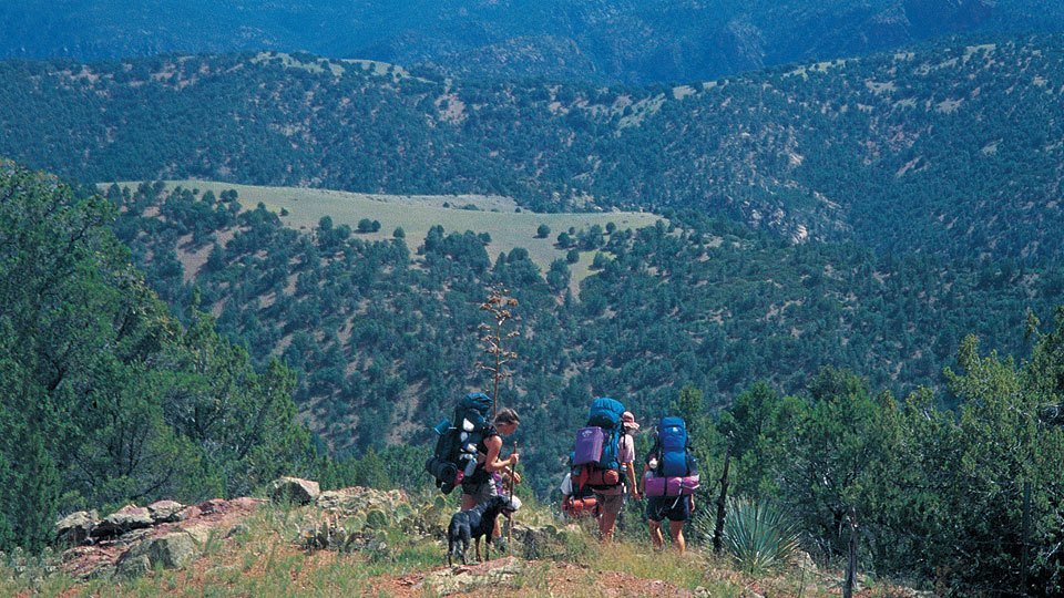
The route continues south and climbs gradually, but nothing like what’s behind you. The trail itself is a mix of rock and red dirt that winds through peaceful stands of scrub oak, alligator junipers, piñon pines and manzanitas. It’s best to appreciate the flora along this trail, because the fauna is less conspicuous. That said, the wilderness area around the trail is home to beavers, black bears, ringtails, mountain lions, skunks and deer. If you see something, feel free to brag about it. If you don’t, you might not even notice because the panoramic views to the southeast are impressive. They’re essentially the same views the Salado people had when they gazed in the same direction during the 12th and 13th centuries. Ditto for the Apaches, who later occupied this area for several centuries before being forced out by white settlers.
Back on the trail, which doesn’t vary a great deal as you move along, you’ll eventually come to a high point that suggests you’re at the end of the hike. But you’re not. Although the trail is a little hard to find at this point, look closely and you’ll see that it continues downhill. A little farther on, you’ll pass some old cattle fencing, and then, 15 minutes after that, you’ll arrive at the Mescal Ridge Tank. The trail veers left past the tank and quickly peters out, officially marking the end of the route.
Because this is a relatively short trail, and you won’t have burned up a lot of clock, you might not be in a hurry to head back down. If that’s the case, Mescal Ridge is a great place to hang out, eat some lunch, take a nap or take in the views. To the southeast you can see Horse Mountain and the endless open space of Tonto National Forest, the fifth-largest national forest in the United States. Whatever you do, don’t lose sight of the trail. Although the surroundings are heavenly, remember, this is Hellsgate, and the last thing you want to do is get lost in a place with a name like that.
Length: 6 miles round-trip
Difficulty: Moderate
Elevation: 4,891 to 5,603 feet
Directions: From Payson, drive east on State Route 260 for 14 miles to Forest Road 405. Turn right onto FR 405 and drive 4.5 miles to the Bear Flat Trailhead at Tonto Crossing.
Vehicle Requirements: A high-clearance vehicle is recommended following rain or snow.
Dogs Allowed: Yes (on a leash)
Horses Allowed: Yes
USGS Map: Promontory Butte
Information: Payson Ranger District, 928-474-7900 or www.fs.fed.us/r3/tonto