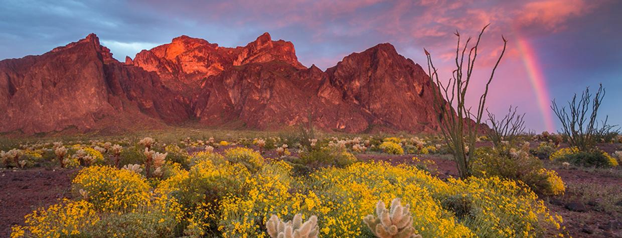
Kofa Mountains, Quartzsite
If Arizona redesigned its flag today, the new version might feature a palm tree instead of a star. For residents of Phoenix and Tucson, the tall, leafy trees known as Washington fan palms (Washingtonia robusta) are as much a part of desert life as cactuses and coyotes. Which is ironic, since those palms are transplants from Mexico. But the closely related California fan palms (Washingtonia filifera) are Arizona originals — and one of the only places to see them in the state is amid the jagged volcanic peaks of Kofa National Wildlife Refuge in Western Arizona.
But the palms aren’t the only stop on this drive, which begins on U.S. Route 95 south of Quartzsite. Head east on Palm Canyon Road, which meanders toward the jagged peaks of the Kofa Mountains — named for the King of Arizona Mine, which produced millions of dollars in gold and silver ore in the early 1900s. Saguaros and ocotillos are scattered along the well-maintained gravel road, which enters the wildlife refuge after 3.3 miles. Pick up a map from the kiosk, then turn left onto Kofa Queen Canyon Road, the first prong of this two-part excursion.
This rutted, rocky road heads northwest for a half-mile, then turns sharply to the east and passes through a vast field of teddy bear chollas. Ahead, rhyolite formations jut skyward like ancient fortifications. Just south of there is 4,859-foot Signal Peak, the Kofas’ highest point. After about 5 miles, Kofa Queen Canyon Road winds into the mountains, with rocky spires on either side of the narrow road. If you have binoculars, use them to glass the hillsides for desert bighorn sheep, which are among the species protected by the 665,000-acre refuge.
After bumping along for a couple more miles, you’ll see a tall, narrow rock column on the left side of the road. Below it is Skull Rock, the turnaround point for this leg. As you might guess, Skull Rock is a large boulder that resembles a human cranium, and years of campfires have blackened the inside of its “mouth,” adding to its spooky appeal. Have a snack, stretch your legs and gear up for the return trip, which offers spectacular views of the plain to the northwest.
Once you’re back at Palm Canyon Road, turn left and head another 3.8 miles east to the parking area for the Palm Canyon Trail. From here, a steep hiking trail leads a half-mile to a spot where you can see the palms; look for the sign with “Palms” and an arrow on it. The palms are tucked into high, isolated side canyons that receive just enough shade and moisture for the trees to survive. Scientists believe they spread into these canyons as the surrounding area warmed and became more desert-like.
Unless you’re a bighorn sheep, you probably won’t want to make the arduous climb up to the palms, so your binoculars will again come in handy. Take your time and enjoy the view of one of Arizona’s rarest plants — and think of Palm Canyon the next time you see a city-dwelling palm tree swaying in a monsoon breeze.
Note: Mileages are approximate.
Length: 20.7 miles one way (from U.S. Route 95)
Directions: From Quartzsite, go south on U.S. Route 95 for 19 miles to Palm Canyon Road. Turn left (east) onto Palm Canyon Road and continue 3.3 miles to Kofa Queen Canyon Road. Turn left onto Kofa Queen Canyon Road and continue 6.8 miles to Skull Rock, on the left. Backtrack 6.8 miles to Palm Canyon Road, turn left and continue 3.8 miles to the Palm Canyon Trail parking area. From here, hike a half-mile to see the palms.
Vehicle requirements: None in good weather for Palm Canyon Road. A high-clearance vehicle is required, and four-wheel-drive is recommended, for Kofa Queen Canyon Road.
Warning: Back-road travel can be hazardous, so be aware of weather and road conditions. Carry plenty of water. Don’t travel alone, and let someone know where you are going and when you plan to return.
Information: Kofa National Wildlife Refuge, 928-783-7861 or fws.gov/refuge/kofa

