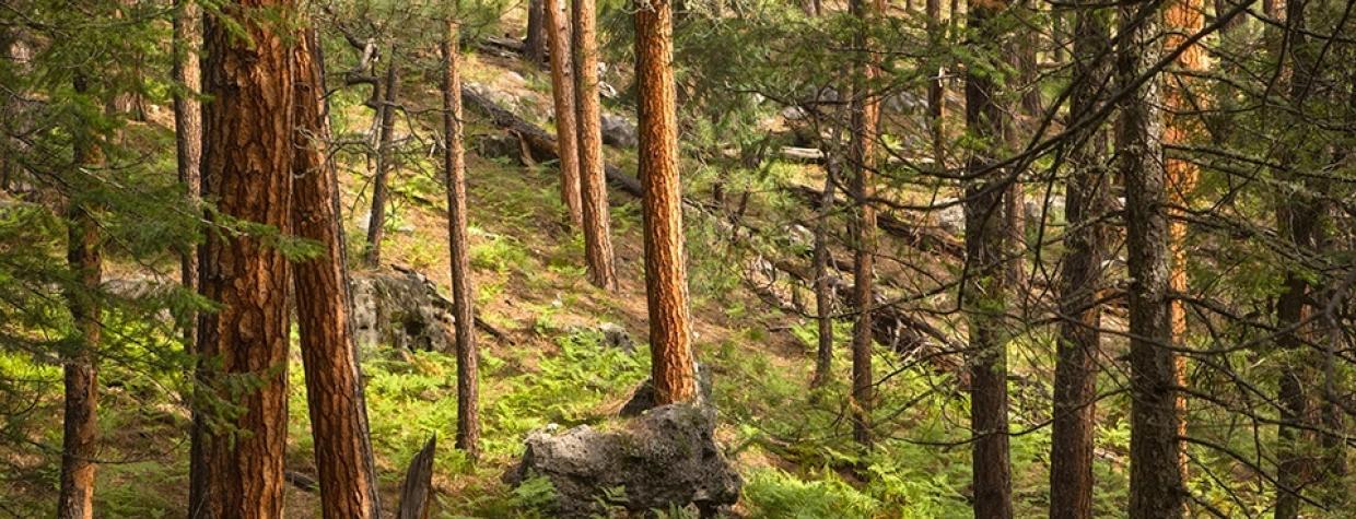
Mogollon Rim, Coconino National Forest
It’s dangerous to dole out superlatives when writing about hikes in Arizona. As soon as you do, you’ll discover one that’s even better than the supposed best. That said, the Houston Brothers Trail might be as good as it gets on the Mogollon Rim. It doesn’t come with the awe of a Grand Canyon hike, and there aren’t any peaks to bag, but it does offer an incredible combination of dense forests, lush meadows and a spring-fed stream that attracts all kinds of wildlife. And this time of year, all of the above are accentuated by autumn leaves.
From the southern trailhead (there’s a counterpart 7 miles to the north), a rocky path winds uphill through a woodland of ponderosa pines. There are a few aspens, too, but most of the fall color on this trail comes from the oaks and maples, which you’ll see about five minutes later when the trail drops into a lush ravine. As quickly as it drops, it climbs back out again. That’s a recurring theme on the first half of the HBT: gentle ups and downs that reveal bold changes in vegetation.
After the second up and down, you’ll arrive at a cluster of aspens protected by a high fence. It’s the first of several revegetation areas designed to keep elk and cattle out. This is elk country, and elk love eating aspens. So do cows. About 30 minutes in, the trail intersects a small forest road and drops down once again. The forest here smells like a forest should smell. Like a balsam sachet, but more natural. It’s the firs that make it so. Beyond the dirt road you’ll cross one of several small creeks that nourish the area. Ten minutes later, you’ll come to a short spur that leads to the Barbershop Trail, another great fall hike.
There are a lot of trails on the Mogollon Rim. The HBT is part of what’s known as the Cabin Loop Trail, which links the General Springs, Pinchot and Buck Springs fire-guard stations. In the last century, the U.S. Forest Service used the trails as a way of getting rangers to the isolated cabins they called home during fire season. In addition, the Houston boys used the trails to move their livestock from one range to another. Today, they’re used primarily by hikers.
Continuing north, you’ll pass an old Engelmann spruce surrounded by dozens of young 10-foot ponderosas. The spruce could hold its own at Rockefeller Center. It’s followed by a couple more ravines, which get steeper and deeper along the way. Eventually, you’ll arrive at Forest Road 139A, which parallels Telephone Canyon. Look left about 50 feet to see where the trail picks up on the other side of the road.
From there, you’ll drop into the Houston Draw, a lush little valley fed by a perennial stream that makes everything brilliant green in the summer. In October, it’s the color of Monet’s Autumn Effect at Argenteuil. The trickling water adds a soundtrack that draws elk, mule deer and black bears out of the woods and beyond.
The water is one of the many highlights of the trail. And so is the spectacular meadow of ferns you’ll see in the valley. It looks almost too perfect for nature, as if the Royal Horticultural Society had a hand in things. Past the ferns is another elk-free zone called the Houston Draw Riparian Exclosure. According to the relic sign, the exclosure “was constructed to see what effects the exclusion of wildlife and livestock will have on the area.” You be the judge.
Although the stream isn’t always visible, you can hear it as you enter another lush meadow that leads to yet another restoration area. Ten minutes later, you’ll arrive at Aspen Springs, a grassy area punctuated with several boulders and large rock outcroppings. The area also includes the remains of a log cabin with a rusted corrugated-steel roof. Expect to see a few tents, too.
From the old homestead, the HBT continues for 1.5 miles to Pinchot Cabin, which is located at what used to be the summer camp of the Houston Brothers Ranch outfit. The cabin was built in the 1930s and is named for former Forest Service Chief Gifford Pinchot, who once visited the area.
This is the turnaround point for the hike. There’s still another 7 miles to go. However, if you’re short on time, you can do the trail with friends and use a car-shuttle system: Take two vehicles, park at opposite trailheads and trade keys when you meet in the middle. Whichever way you do it, there’s a good chance you’ll drive away thinking: This might be the best hike on the Mogollon Rim.
Length: 14 miles round-trip
Difficulty: Moderate
Elevation: 7,732 to 7,170 feet
Trailhead GPS: N 34˚25.153’, W 111˚12.962’
Directions: From Payson, go east on State Route 260 for 29.2 miles to the turnoff for Woods Canyon Lake. Turn left and continue on the paved road for 3.1 miles to Forest Road 300. Turn left onto FR 300 and continue 23.8 miles to a dirt parking lot on the left. The trailhead is located just beyond the parking lot, on the right.
Vehicle Requirements: A high-clearance vehicle is recommended.
Dogs Allowed: Yes (on a leash)
Horses Allowed: Yes
USGS Map: Dane Canyon
Information: Mogollon Rim Ranger District, 928-477-2225 or www.fs.usda.gov/coconino

