
Kaibab National Forest, Williams Ranger District
The Bill Williams Mountain Loop makes a short, easy drive through some of the most beautiful ponderosa pine forest in Northern Arizona, with opportunities to see wildlife and learn a little area history. Beginning in the center of Williams, the drive circles Bill Williams Mountain, which rises to an elevation of 9,170 feet. The 30-mile loop can be completed in an hour or two.
The drive begins at the Williams and Forest Service Visitor Center on Railroad Avenue. The center is located in the historic Atchison, Topeka and Santa Fe Railway freight depot, built in 1901. It’s worth a visit. Many of the architectural features remain, as does a freight scale.
Most people think of Williams as a Historic Route 66 town or the southern terminus of the Grand Canyon Railway. The exhibits in the small museum tell the larger story of an area at the center of a well-traveled crossroads, beginning with ancient Indian trade routes. Using these trails, Edward Fitzgerald Beale built his wagon road across the West in the mid-19th century. Portions of that road became Route 66. In between, the Atlantic and Pacific Railroad followed roughly the same course, bringing ranching and timbering.
Of course, the most recent road to follow that well-worn path is Interstate 40. Williams was the last town to have its section of Route 66 bypassed, thanks to lawsuits that kept the last section of I-40 from being built around the town. The suits were dropped after the state agreed to include three exits for Williams. That portion of the interstate opened in 1984, and Route 66 was decommissioned the following year.
From the visitors center, we head west on Railroad Avenue and turn left onto Fourth Street, which becomes Perkinsville Road. Leaving town, we pass the Santa Fe Dam, built in the early 1890s by the railroad. Until the advent of the diesel locomotive, the reservoir created by the dam held water for steam engines traveling through Williams. These days, it’s a popular fishing and picnic spot.
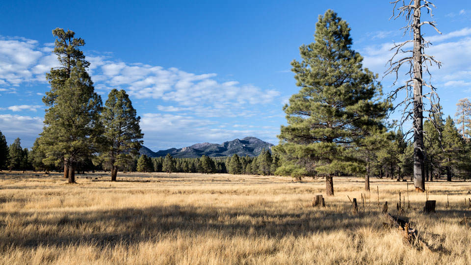
After about 6.5 miles, we turn right onto Forest Road 108, the Bill Williams Loop. The wide, well-maintained red-cinder road winds through a lovely stretch of ponderosa-pine forest. Tall, well-spaced pines punctuate a lush carpet of grass, giving way to expansive, high-mountain meadows and occasional rocky outcroppings. The effect is so serene and well-mannered, it looks almost park-like.
After 2 miles, we come to Coleman Lake. Caution signs warn of areas of deep water, but the drought has left the lake looking like little more than marshland. Even so, it’s a great place for wildlife-viewing. Elk, deer and Merriam’s turkeys are common, and bald eagles winter here.
A few miles down the road, a few mule deer run across the road ahead of us. They stop just up the hill to watch us pass. It’s likely that we disturbed their visit to MC Tank, a small stock pond at the side of the road that reflects a swimming-pool-blue sky and cotton-ball clouds.
After about 8 miles, we see the turnoff to the Stage Station Trailhead. The 7.9-mile mountain-biking loop winds along a primitive road past a structure that marked a water and rest stop along an old stage route between Williams and Prescott.
Moving on, the forest dips occasionally into juniper grasslands, opening up views of Bill Williams Mountain. After a little more than 18 miles, we hit the pavement and take I-40 back to Williams.
Note: Mileages are approximate.
Length: 30-mile loop
Directions: From the Williams Visitor Center (200 W. Railroad Avenue), go west on Railroad Avenue for 0.1 miles to Fourth Street. Turn left onto Fourth Street, which turns into Perkinsville Road (County Road 73), and continue 6.6 miles to Bill Williams Mountain Loop Road (Forest Road 108). Turn right onto Bill Williams Mountain Loop Road and continue 18.3 miles to Interstate 40. Turn right onto I-40 and continue 5 miles back to Williams.
Vehicle requirements: None in good weather.
Information: Williams Ranger District, 928-635-5600 or www.fs.usda.gov/kaibab
Travelers in Arizona can visit www.az511.gov or dial 511 to get information on road closures, construction, delays, weather and more.