
The first thing you need to know about this hike is that it might be the last one you ever want to do in the San Francisco Peaks. That’s because it comes with just about everything — scenery, solitude and sweat — and the next time you’re planning an outing around Flagstaff, you’re going to wonder: Why would I hike anything but the Abineau-Bear Jaw Loop? It might be the perfect hike.
From the secluded trailhead, which sits waiting at the end of a series of forest roads, the loop begins as a wide path through a grassy meadow surrounded by aspens, ponderosas, black bears (which you probably won’t see) and elk (which you might). Then, before you know it, it arrives at a junction where the Bear Jaw Trail splits left and the Abineau goes right. Like any loop, either way will work. This listing runs clockwise, so veer left.
Initially, the trail drops slightly, and then, about 25 minutes in, it crosses into the Kachina Peaks Wilderness, which was designated in 1984, comprises 18,960 acres and protects a volcanic mountain range that’s sacred to the Hopis, Navajos, Havasupais, Zunis and other American Indian tribes. This is where the uphill workout begins, and where Humphreys Peak — the highest point in the state (12,633 feet) — makes its first appearance.
Fifteen minutes later, you’ll reach the ridge of Bear Jaw Canyon and get another look at the peak. Just beyond that look, the trail passes a bizarre grove of “bowing” aspens. There are hundreds of them, maybe thousands, bent to one side by some force of nature. Wind or snow is the likely cause. And it’s probably snow — in normal years, this wilderness area gets a lot of it. On most of the trails in Arizona, you won’t see anything like these unusual trees. It’s a twist of Mother Nature.
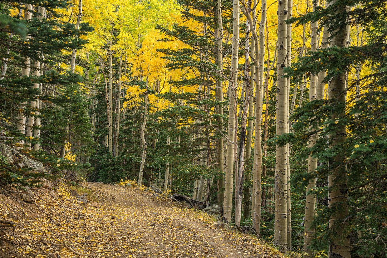
Moving on, the well-marked trail passes through another grove of aspens. Arguably, the most beautiful grove in Arizona. (The hyperbole you’re wondering about will wane when you see the trees for yourself.) Linger a little, and look and listen for wildlife. In addition to bears and elk, you might see wild turkeys and Abert’s squirrels, as well as Steller’s jays, blue grouse, Western bluebirds and white-throated swifts. You’ll want to hit this trail before the leaves start to fall. It’s nice in the late spring, too.
The next big landmark is the pipeline road that connects the two trails that make up this beautiful loop. It’s a narrow jeep road that climbs gradually into an ecosystem that includes Engelmann spruce, Douglas-firs and more aspens. The aspens are everywhere on this trail.
Eventually, after 2 miles on the dirt road, you’ll leave the forest and arrive at the high point of the hike. You’ll know you’re there when you see an intersection with the Abineau Trail, which cuts left for a short distance to Abineau Spring, and right to continue the loop. Before you go, you’ll want to take off your backpack and take a look around.
The scene is dominated by views of the San Francisco Peaks (Humphreys, Doyle, Fremont and Agassiz) to the south, but the look to the northwest is nice, too. Among other things, the Grand Canyon — some 90 miles away — appears as a wide gap in a broad plateau that stretches from the foot of the mountain to the horizon. Mother Nature likes to show off on this trail, and this is where she makes her boldest statement. Enjoy the views and the solitude you’ll surely be experiencing — the north slope of the San Francisco Peaks doesn’t get a lot of foot traffic.
Back on the trail, the downhill run kicks off with a mad scramble over a field of rocks the size of Oldsmobiles. The rocks are remnants of a massive avalanche that dramatically altered the landscape in 2005. It’s a fascinating look at what can happen when a mountain shrugs its shoulders, but watch your step. The trail at this point is tricky, steep and sloppy, and it stays that way for about 20 minutes, until it drops back into the woods and out of the sun.
From there, it winds for about 2 miles through Abineau Canyon, under a canopy of aspens and evergreens, back to where you started. But that’s not the end. Unless you’re averse to scenery, solitude and a surge of adrenaline, you’ll be back on this loop again. As you’ll see, Abineau-Bear Jaw might be the perfect trail, and it’s arguably the best way to explore the north slope of the San Francisco Peaks.
Trail guide
Length: 6.8-mile loop
Difficulty: Moderate
Elevation: 8,536 to 10,284 feet
Trailhead GPS: N 35˚23.177', W 111˚40.601'
Directions: From downtown Flagstaff, go north on U.S. Route 89 for 15.7 miles to Forest Road 552, which is directly across from the turnoff to Sunset Crater Volcano National Monument. Turn left onto FR 552 and continue about a half-mile to a “T” intersection. Turn right to stay on FR 552 and continue 1 mile to Forest Road 418. Turn right onto FR 418 and continue 8.1 miles to Forest Road 9123J. Turn left onto FR 9123J and continue 0.5 miles to the trailhead.
Vehicle Requirements: None
Dogs Allowed: Yes (on a leash)
Horses Allowed: Yes
USGS Maps: Humphreys Peak, White Horse Hills
Information: Flagstaff Ranger District, 928-526-0866 or fs.usda.gov/coconino