
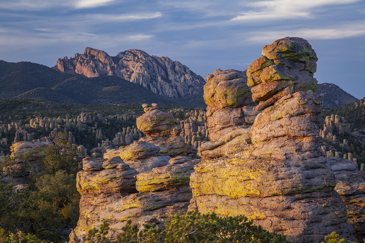
The Apaches called them “standing-up rocks.” Today, people call them hoodoos or pinnacles or the most amazing rock formations they’ve ever seen. Any of those will work when referring to the centerpiece of Chiricahua National Monument.
Although the hoodoos can be photographed from a car window, the most impressive formations are hidden away in the Heart of Rocks Loop, which can be reached in a few different ways. For this narrative, you’ll begin at the monument’s visitors center by hopping on the Lower Rhyolite Canyon Trail, one of two connector trails that lead to the loop.
From the east end of the parking lot, the easy-to-follow dirt path is instantly recognizable as the handiwork of the Civilian Conservation Corps. A canopy of trees shades the single track, which parallels Bonita Creek and attracts a wide variety of birds, including many species from Mexico. Throughout the day, you might also see white-nosed coatis, white-tailed deer, mountain lions, black bears, all four species of skunks native to Arizona (spotted, striped, hooded, hog-nosed) and Chiricahua fox squirrels — a species found only in these mountains. Black-tailed rattlesnakes live in the park, too. Keep your eyes and ears peeled.
Almost immediately, the trail starts to climb, and it won’t let up until you’re in the loop — in all, the route ascends more than 1,500 feet. But first, you’ll start seeing hoodoos to the left. Rows and rows, some as big as U-Haul trucks, set against a phthalo blue sky. You’ll see signs of horses, too. Although they’re not allowed in the Heart of Rocks, they are permitted on the two connector trails. About a half-hour in, you’ll come to the second of those, the Sarah Deming Trail. Veer right.
The first thing you’ll notice in Sarah Deming Canyon is that the trees start getting bigger. The monument is home to ponderosa pines, Douglas-firs, Engelmann spruce and Apache pines, along with many hardwoods. In addition to the hoodoos, the diversity of plant life in the park — there are more than 1,000 species — is one of the most impressive things about this hike. So is the sound of water, which can be heard from the trail if the summer monsoon brings some rain.
Eventually, after about an hour of hiking, the trail crosses the creek that carries the water and begins another steep climb toward the Heart of Rocks. But even before you get there, you’ll start seeing some of the unusual shapes.
“The formations, owing to their semblance to animate objects, have been given names,” A.H. Gardner wrote in this magazine in September 1925. “For instance, there is Andy Gump, the Face, the Lizard, Judge Rumhauser, the Old Hen, the Shoe, the Totem Pole, Thor’s Hammer, the Water Jug, Sweet Potato, Punch and Judy, Old Lady Sniff-Sniff, the Sheep, the Three Brothers, the Camel, and hundreds of other rock formations representing almost anything of which one can think.”
A century later, only Punch and Judy, Thor’s Hammer and the Camel are still around. The others have either crumbled or had their names changed. In any case, these unique formations are the highlight of the hike and the focal point of the loop, which can be hiked counterclockwise or clockwise. The National Park Service recommends the latter, and that’s how this piece is written.
The first formation with an official name tag is Pinnacle Balanced Rock. You won’t wonder how it got its name. The Old Maid and Camel’s Head are next. Then, just beyond Thor’s Hammer, you’ll get a stunning look at Cochise Head off in the distance. From there, the loop winds around to Punch and Judy, which mark the geographical high point of the hike — 6,920 feet.
Although the loop takes only about 25 minutes, there’s enough time to think about the history of the area. Long before the establishment of Chiricahua National Monument, this place was the home of the Apaches, including Cochise, Geronimo and others. As you look around, you’ll understand why it appealed to them. The “standing-up rocks” make up one of the most amazing landscapes you’ll ever see.
Trail Guide
Length: 7.5 miles round-trip
Difficulty: Strenuous
Elevation: 5,366 to 6,920 feet
Trailhead GPS: N 32˚00.335', W 109˚21.361'
Directions: From Tucson, go east on Interstate 10 for 71 miles to Exit 336 in Willcox (an I-10 business route). Veer right onto the business route and continue 3 miles to State Route 186 (the first stoplight). Turn right onto SR 186 and continue 32 miles to State Route 181. Turn left onto SR 181 and continue 4 miles to the Chiricahua National Monument entrance. The trailhead is at the east end of the visitors center parking lot on Bonita Canyon Drive.
Vehicle Requirements: None
Dogs Allowed: No
Horses Allowed: No, but horses are allowed on the Lower Rhyolite Canyon and Sarah Deming trails.
USGS Map: Cochise Head
Information: Chiricahua National Monument, 520-824-3560 or nps.gov/chir