
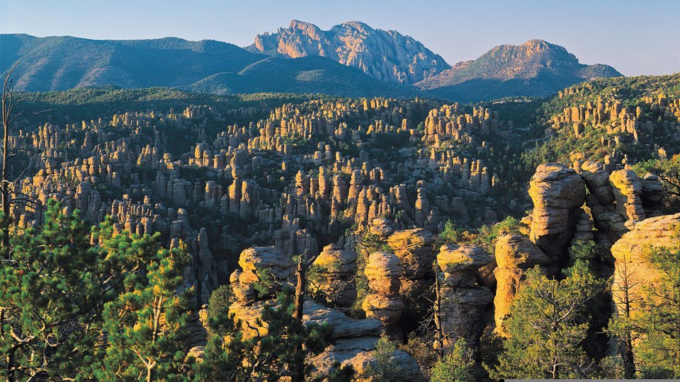
Chiricahua National Monument
Walking in circles is usually discouraged, but not when it comes to hikes. Loop hikes are great because they're typically easy to follow and you never have to retrace your steps. Echo Canyon Loop is no exception. Like most loops, there's no right or wrong approach to this trail. That said, most hikers opt for the counterclockwise route because it's a little easier. But really, there's nothing difficult about this trail, other than the challenge of coming up with enough adjectives to describe what is surely one of the most geologically unique trails in Arizona.
From the trailhead, the counterclockwise route hits its first junction almost immediately. You'll see a sign that points toward the "Grottoes." Head that direction, but before you split, turn around and take a gander at the enormous rock formation in the distance, known as Cochise Head. If you use your imagination, it looks as if the renowned Apache chief is lying on his back and looking up toward the sky.
Heading downhill, you'll arrive at the grottoes in a matter of minutes. Although these passageways invite exploration, it's important that you stay on the trail, not only because of the Leave-No-Trace Principles, but also because there are several dangerous drop-offs within the grottoes. It's even more dangerous when it's wet, which is often the case in the spring.
Just beyond the grottoes is Echo Park, a lush cove dominated by Apache pines, Douglas firs and Arizona cypress. You shouldn't be tired at this point, but if the breathtaking beauty is taking a toll, this is a great place to kick back and take a break. In addition to the trees and the other greenery, there's an unexpected stream that runs through this little Eden in the winter and spring. There are even a few waterfalls that'll trick you into thinking you're somewhere else. Perhaps somewhere in North Carolina.
The next segment of the loop heads into Rhyolite Canyon along the Hailstone Trail. It's drier and hotter along this stretch, which skirts the south-facing wall of the canyon for just under a mile. After a mile, a third junction connects the Hailstone Trail to the Ed Riggs Trail. This is where the only workout on the route begins. This hike is rated as Moderate, and could almost earn an Easy rating, but along Ed Riggs there's an uphill climb that'll get your attention. It's nothing like the switches on the North Kaibab Trail, but it's uphill all the way back to the trailhead. That, of course, completes the loop; however, if you have the time, you might want to make a detour at the loop's fourth intersection, which shows up about an hour and a half into the hike.
The side trip leads to Massai Point, where the CCC built a wonderful lookout tower that offers long views of most of the monument and beyond. Although the trek to Massai Point adds about a half-mile total to the Echo Canyon Loop, the views from the top are well worth the extra steps. Besides, on a trail where walking in circles is OK, there's certainly nothing wrong with getting sidetracked, as well.
Length: 3.5 miles round-trip
Difficulty: Moderate
Elevation: 6,784 to 6,330 feet
Directions: The trailhead is located at the Echo Canyon Trail Parking Area, 5.5 miles past the Chiricahua National Monument visitors center on Bonita Canyon Drive.
Vehicle Requirements: None
Dogs Allowed: No
USGS Map: Cochise Head
Information: Chiricahua National Monument, 520-824-3560 or www.nps.gov/chir