

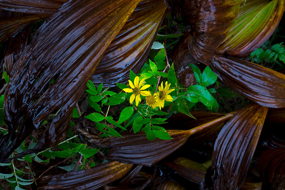
Delicate wildflowers bloom among the leaves of corn lilies in the Chiricahua Mountains of Southeastern Arizona. As a “sky island” range, the Chiricahuas harbor many plant and animal species not found in the desert surrounding the mountains.
Joel Hazelton
CANON EOS 6D, 0.8 SEC, F/16, ISO 200, 35 MM LENS
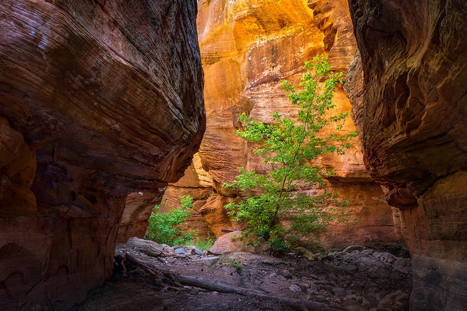
The steep walls of Secret Canyon, in the Sedona area’s Red Rock-Secret Mountain Wilderness, cradle a solitary tree. The Secret Canyon Trail, a well-used hiking route, meanders in and out of the bottom of this canyon.
Larry Lindahl
CANON EOS 5D MARK III, 2 SEC, F/18, ISO 100, 35 MM LENS
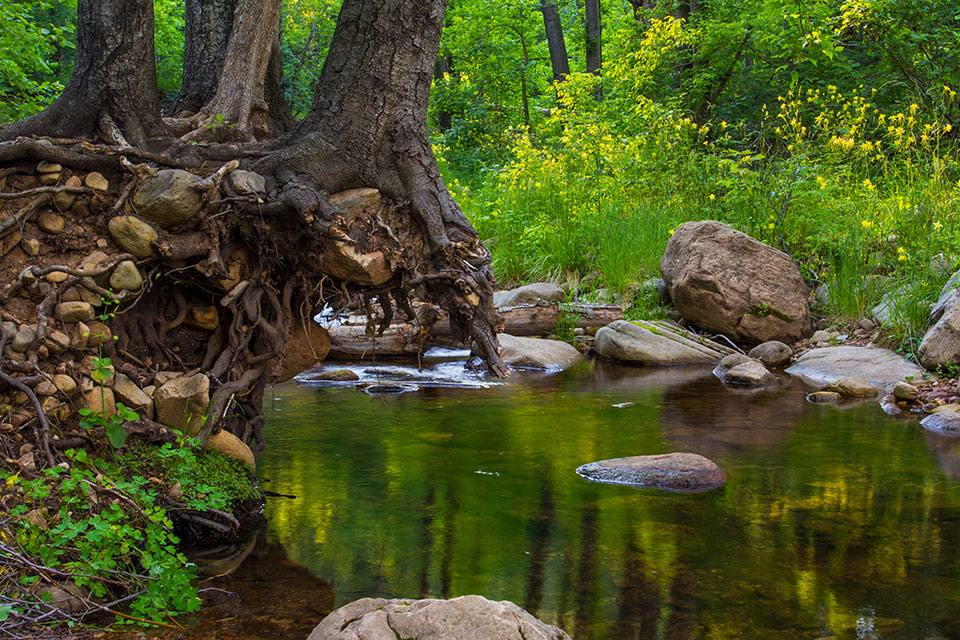
Columbines line the verdant banks of Christopher Creek, east of Payson on the Mogollon Rim. Here, flooding has washed away part of the creek’s banks, leaving the roots of hardy trees exposed.
Joel Hazelton
CANON EOS 6D, 0.4 SEC, F/11, ISO 100, 28 MM LENS
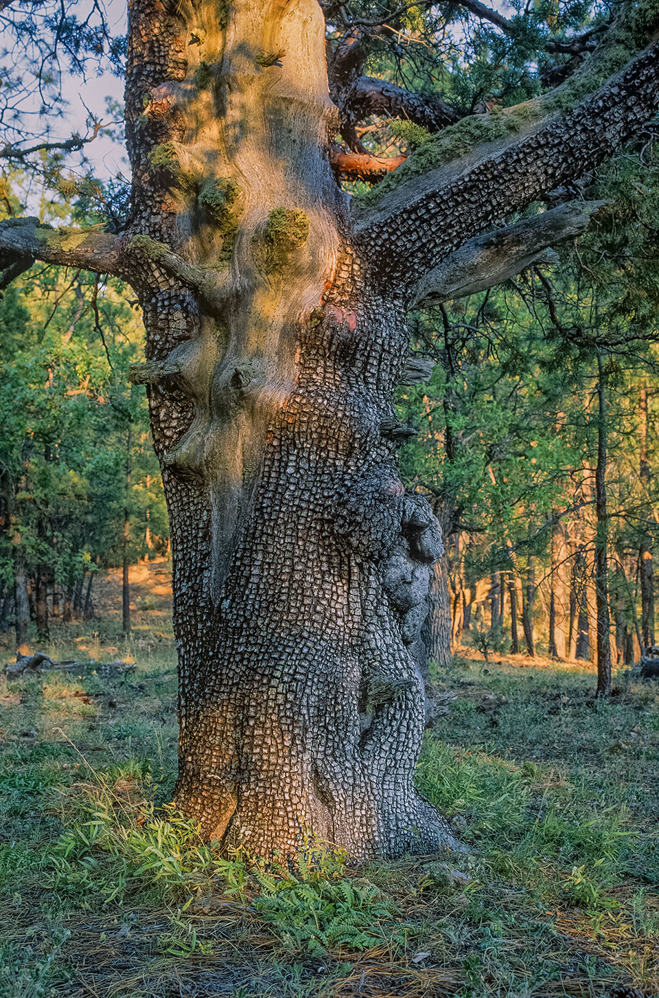
The setting sun illuminates an alligator juniper in the Sedona area’s Loy Canyon. Named for a family that ran cattle there in the late 1800s, the canyon can be explored via the Loy Canyon Trail, a remote hiking route.
Larry Lindahl
NIKON FE2, FUJICHROME VELVIA, ISO 50, 35 MM LENS
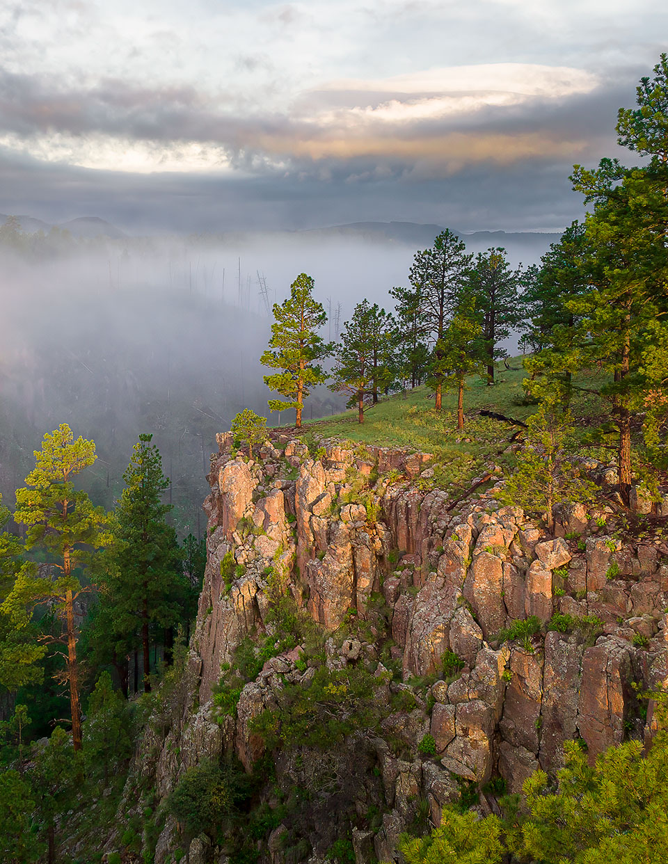
Morning light bathes ponderosa pines and other evergreens on a misty morning above the San Francisco River. This key Eastern Arizona waterway is the largest tributary of the upper Gila River.
Rusty Childress
HASSELBLAD L2D-20C, 1/500 SEC, F/2.8, ISO 170, 12.3 MM LENS
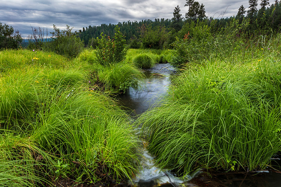
Clumps of tall grass crowd the banks of the West Fork of the Black River, in the White Mountains, amid an approaching storm. The river originates near Alpine and flows for 114 miles to where it joins the White River to form the Salt River.
Claire Curran
CANON EOS 5DS R, 1/5 SEC, F/20, ISO 100, 24 MM LENS
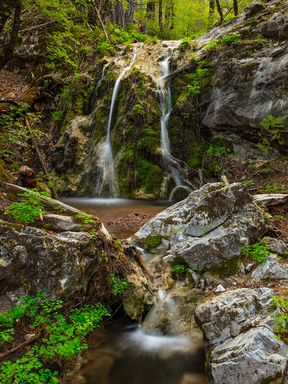
A small stream flows over a waterfall in Pat Scott Canyon, part of the Huachuca Mountains’ Miller Peak Wilderness. This Southern Arizona wilderness area is known for its deep canyons, high cliffs and diversity of bird and mammal species.
Joel Hazelton
CANON EOS 5DS R, 3.2 SEC, F/16, ISO 100, 33 MM LENS
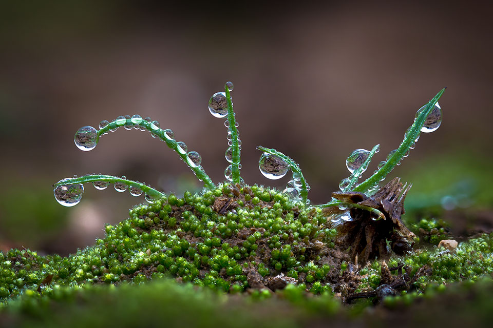
Water droplets collect on tiny sprouts along a wash in the Sonoran Desert. The droplets are the result of guttation, a process by which vascular plants secrete moisture from their leaves.
Eirini Pajak
Canon EOS 5D Mark III, 1/160 Sec, F/4.5, ISO 400, 100 MM Macro lens (Focus stack of 160 images)
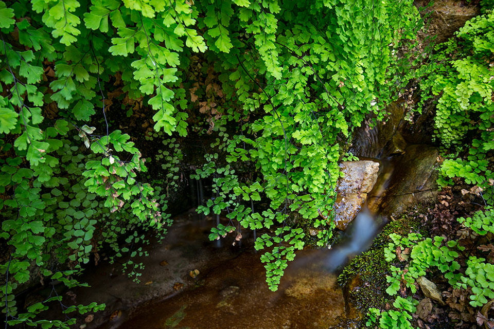
Hanging foliage grows along a perennial spring that feeds East Clear Creek, a waterway on the Mogollon Rim. The Kinder Crossing Trail, which begins near State Route 87, is an ideal way to experience this creek’s scenery and cool water.
Joel Hazelton
CANON EOS 6D, 30 SEC, F/18, ISO 100, 23 MM LENS