
The rays of the rising sun bathe the mesas in golden light. They stand out sharply against the western horizon. Long gray shadows shorten to purple haze; a new day begins on the Painted Desert.
In the distance a pinkish white cloud-like form floats above the unending void of space and stands motionless as the mounting sun reaches its zenith before starting the downward glide toward the Western world. Aloof and alone, blue at its wide-flung base and snowy white at its summit, the mighty monarch of the North stands guard over Northern Arizona.
A Hopi priest chants his prayer to the Hopi gods who dwell at the top of the San Francisco Peaks. He beseeches them to watch over his clan and to deliver a bountiful harvest. The Navajo doctor destroys his sand painting, faces the distant Peaks and prays that his tribe of nomads comes to no harm.
A mountain born of fire and smoke, flying sparks and showers of cinders, built up during tens of centuries of volcanic action, watches over the descendants of ancient America, a mountain once a thunderous inferno but today a cone of pine-clad beauty.
The San Francisco Peaks of Northern Arizona are the closely spaced and jagged summits at the edge of a single volcanic crater. They are referred to as the “Peaks,” but the mountain is in fact one symmetrically shaped ancient volcano, whose cinder-spouting summit was once a thousand feet higher than the present elevation of 12,700 feet above the sea.
A final outburst of Vulcan’s activity was too much for the tremendous weight of the ever up-building lava cone. There was a tremendous explosion, and the volcano settled down to a quiet pine-clad mountain.
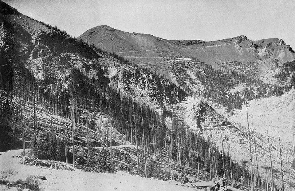
The virgin beauties of the mountain have been penetrated by a highway. The road is the result of the efforts of John Weatherford of Flagstaff, whose dream came true shortly before his death in 1934.
The motor trip to the top of the Peaks is made in two hours. The road negotiates the five-thousand-foot climb in thirteen miles, through dark isles of yellow pine, then spruce, quaking aspen and finally the scrubby alpine fir.
At the thirteen-thousand-foot elevation there unfolds the broadest vista in the Southwest. The states of Utah and New Mexico are visible on clear days, and one with a vivid imagination can discern the meeting place of Colorado, Arizona, Utah and New Mexico. The round dome of Navajo Mountain is visible just beyond the Arizona border, where Utah stretches northward and is lost in the haze. New Mexico, a hundred and fifty miles away, is lost in the haze of the Painted Desert and below the curvature of the Earth.
Southward and above the vast pine forest of the Mogollon Rim, the prongs of the Four Peaks in the Mazatzals peek over the high ranges of the Salt River region near Theodore Roosevelt Dam, 110 miles in the distance. To the west is the tip of the Hualapai Mountains.
The Grand Canyon of the Colorado appears almost at the feet of the observer. The distance is 50 miles to the Hopi Watch Tower at Desert View. The Grand Canyon appears as a dark, winding cleft in the Earth’s surface.
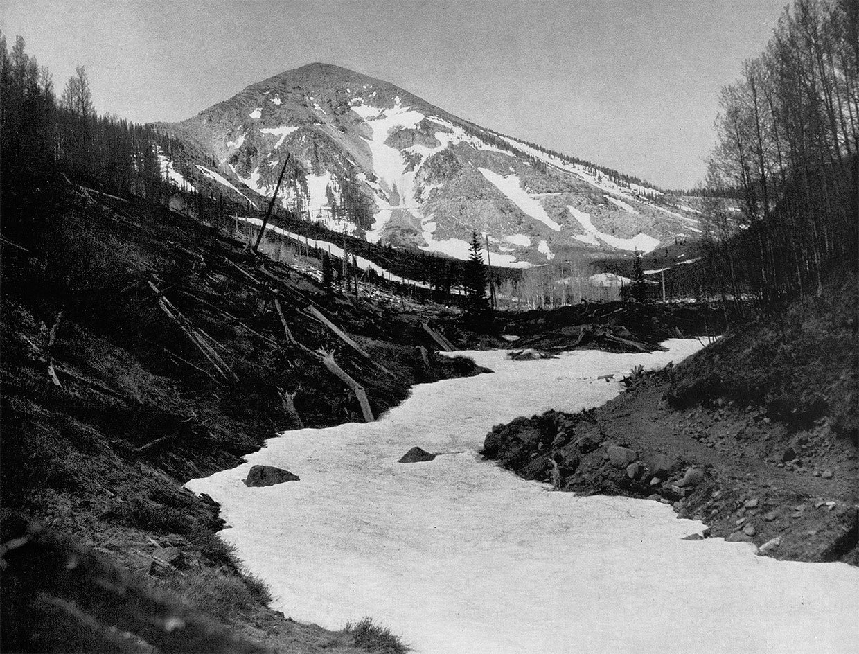
On the eastern slope, a bowl-shaped crater is filled with perpetual snow. A complex system of pipelines supplies Flagstaff with pure soft water.
that no longer exists. | Norman G. Wallace
The geological makeup of the San Francisco Peaks is peculiar. Once a nearly flat tableland of sandstone and limestone and but a few miles north of the Mogollon Rim drop-off into Southern Arizona, the region is now entirely covered with a thick flow of cooled lava and numerous small cinder craters, the Peaks themselves being the climax to ancient volcanic activity.
One of the smaller craters near the base of the mountain is composed of lime and sandstone layers upturned around the crater’s rim, much as if an explosion of dynamite had shattered the once-horizontal layers. Strangely enough, a red sandstone quarry lies at the base of the Peaks with a top layer of cooled lava. Vulcan’s work is everywhere evident.
Three principal peaks comprise the mountain. They are Agassiz, 12,300 feet; Fremont, 11,940 feet; and Humphreys — highest in Arizona — 12,655 feet.
The superstitious Hopi Indians worship this mighty monarch of the North. They know it as “the high place of snow.” The Havasupai Indians call the mountain Hue-hass-a-patch. Hue in their language means “mountain” or “big rock.”
When and by whom the San Francisco Peaks were named, and for which of the two eminent saints of that name they were called, has escaped the observation of historians so far. Some authorities credit their discovery and naming to Marcos de Niza in 1539.
Later, a geologist with the Whipple exploration party said: “This cone is on the left bank of Colorado Chiquito. It is unfortunate that this lofty and inspiring peak cannot be distinguished by a name which shall not lead to endless misapprehension of its position as being near the great city of the Pacific coast. If the Indian name for it can be learned, it should be adopted.”
Nestled at the foot of the mountain is the picturesque city of Flagstaff, the county seat of Coconino County and the home of the famous Lowell Observatory. Lieutenant Beale first camped at Leroux Spring near the town on April 15, 1858. The Indians were then calling the lofty pinnacles the San Francisco Peaks.
Equally confusing is the name of the city of Flagstaff, which has been the subject of much debate by pioneers and historians. The Flagstaff Chamber of Commerce gives the following, which is undoubtedly correct:
“In June 1876, a party of immigrants from Boston came on westward after a failure to settle in the Little Colorado Valley. One of the party tells of stripping a small pine tree and raising a flag upon it. Around this extemporized flagpole the party celebrated on July 4, 1876. Thus the name Flagstaff was attached to the spring and was retained on the establishment of a construction camp of the Atlantic and Pacific railroad in 1882.”
The seasons reflect their various moods in the mighty monarch of the North. In summer the white billowy clouds form around the sharp points piercing the sky and then drift over the valley of pines below to shower almost daily the evergreens with cool rain. Fall arrives early in the Peaks country, and Jack Frost paints overnight the quivering green quaking aspen leaves a golden yellow or brilliant orange. Soon the entire mountain is blotched with color. Green pine needles stand out in vivid contrast to the red of Nature’s paint pot.
Soon the summit is mantled with its coat of pure white. Winter’s fog obscures the peaks while King Boreas busily piles the snow deeper and deeper. The storm dies or drifts eastward over the Painted Desert. A setting sun paints shafts of gold against the sharp Peaks as they emerge above a cloud-enveloped space. Smooth white slopes gleam against a vaulted dome of blue. Darkness hides the green pine-clad valleys, and night’s veil rides in from the East.
A hidden sun, long gone below a Western world, illuminates the topmost peak with pinkish light, which swiftly dissolves to rose as darkness blots out the world below.