
From time to time, the people of Phoenix realize they’re living in an aquaculture empire. Flocks of blackbirds wheel over canals that lace the city, and the air in certain neighborhoods smells slightly green from irrigation water. When I was a kid, we lived for a spell where sports fields and lawns were still being flood-irrigated. Ordinary lots turned into grassy pools and lakes. I’d go barefoot hopping from one to the next, up to my knees in the redirected waters of the Salt River.
My mom, prone to weekend adventures, went to Kmart and bought a cheap inflatable raft, and one blazing summer, we took it to the river’s reservoir system, built up in dry heaps and spikes of mountains to the east. This is where the Salt River has been impounded by dams, a magical land, in my eye, where streets fell away and asphalt turned to dirt, horizons populated with saguaros and ridges of rhyolite the color of dried blood. Saguaro Lake is the closest to the city, 40 miles from downtown, 15 or 20 from its outer edges. We didn’t drive to the marina, with its many boats and wake zones, but out to a dead-end road, a place to park and inflate our raft with a foot pump, load it with a sack of groceries for a picnic and shove off across the grand blue bay.
The lake belongs to the lowest tier of dams nested above the city, where mirrored water screams with speedboats on a reservoir 10 miles long and about a hundred feet deep. It’s blistering in the summer: You sit on a cooler with a fishing rod as a double sun — one above, the other reflected from the water — sears your face. In winter, rivers of air roar down the canyons, funneled by narrow walls, blustering into coves like a brawl, fists punching through paloverdes and creosote.

My curly-haired mom worked the aluminum-handled oars on our raft as I sat up front, watching speedboats on our horizon, white streaks of sound passing at 30 mph, water-skiers in tow. She aimed us toward a point of rock with a bit of a shoreline half a mile away, and she had me up on the tube so we’d be more visible to faceless pilots hidden behind bows lifted up and smacking the lake. Pilots veered and waved, and even the skiers in tow lifted a hand at us, seeing a woman and a kid in a raft with a sack of groceries rocking in the middle, potato chip bag sticking up like a sail.
On the other side, we landed on bleached rocks, the shoreline scabbed from rising and falling lake levels. Unlike Lake Powell in the north along the impounded Colorado River, the smaller reservoirs of the Salt River can be filled and lowered more quickly to meet the demands of the city and its many canals and fields below. Fluctuations rake the edges where I hopped out in plastic elementary school flip-flops, setting foot on a point of rock bristled with chollas, green summer skeletons of paloverdes and ocotillos leafless in the heat. My mom came ashore behind me with our sack of groceries, and we laid out a Central Arizona picnic on the lowest lake in the chain.
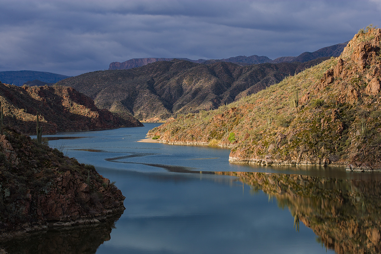
Four major reservoirs climb the Salt River: Saguaro, Canyon, Apache and Theodore Roosevelt. Canyon is the second up in the chain, and the most encompassing view I’ve had of it was from a helicopter. A Salt River Project water survey was flying up 150 miles of the Salt, from Phoenix to the highland headwaters, and I tagged along in the back seat as a writer. The company’s head hydrologist, in the front, directed the pilot this way and that, eyeballing springs and seeing if little canyons had trickles or were bone dry. Hovering and turning like a dragonfly, we ducked into fractal side canyons gathered tightly around Canyon Lake.
As we floated with a terrible roar in the echo chamber of a side canyon, the pilot asked if I’d seen cliff dwellings up here. I said no, and he got a nod from the hydrologist. Rising into our own echoes, we climbed a rock chute the color and texture of walnut bark. Cliffs fell around each other like sheets hung to dry, and the pilot positioned us looking into a masonry chamber, a small dwelling built as if in the wall of a castle, construction date around 1300.
The helicopter dropped back to the reservoir, and we tracked its narrow blue course, the lake more than a hundred feet deep for 10 miles and only a few hundred feet wide most of the way. When full, Canyon Lake holds the equivalent of about 60,000 eight-lane swimming pools, making it the smallest of the four reservoirs, lacking the gaping sky of Saguaro Lake. It is a ribbon pinched between the ragged Four Peaks Wilderness on one side and the bold steamships of the Superstition Mountains on the other. The most open airspace you can find is right over the water.
We leveled off, heading upstream, maintaining enough altitude to see cliffs plunge beneath the surface, their curtains turning pale, then dark as they sank into black vaults underwater. Again, the pilot asked if I knew of a Native site out here, just beneath the surface, and I said no. He told me to look down, and through the helicopter bubble,
I saw a grid of room blocks passing below, like the face of a ghost just below the water. A pueblo had been built on a hilltop now drowned by the lake. I recognized its floor plan — a grid shape 800 years
old, maybe a thousand — as a remnant of the Hohokam culture, the original inhabitants of this place. The pilot slowed for a circle, letting me look into these exposed chambers, walls ruined by centuries of erosion and lapping lake levels, not breaching the surface but 20 or 30 feet below.

We stayed for only a moment, and he put us back on course, sending us up to the gray concrete shell of the next impoundment, Horse Mesa Dam, built in the 1920s, 305 feet high and 660 feet wide, Art Deco spillways draped down one side. We rose to the height of the concrete arc and slipped over to Apache Lake.
Apache has a depth of around 250 feet and goes on for 17 miles. Third largest of the four lakes, it is shaped like an intestinal organ unraveled for study, its interior knobbed with peninsulas and coves. When, in 2012, one of the internal penstocks within the dam began crumbling, throwing huge pieces of concrete into the hydroelectric turbines, there was talk of draining the entire lake for repairs. That would have been exciting to see, the Salt River flowing once more into the heart of Phoenix, but instead, a team of construction divers lived for a month at a time in underwater housing and diving bells to make the needed repairs. I imagine the quiet of the lake a couple hundred feet under, where divers worked in the bowels of a drowned canyon, a place where ancient villages once hugged the shores of a cool river flowing down from the mountains. It must have been absolutely silent down there.
Winter is when I prefer to be on the water. Weather can be hard, but on clear days, the air can be warm and few boats come to the inner reaches. My wife was on a paddleboard, and I navigated a canoe loaded with gear and a week of supplies. We saw only a few boats each day, fishing skiffs puttering along, and each morning we’d see one solo sculler slicing across the water, followed by a coach in a motorized Sun Tracker going to the dam and back. We camped in rocky coves, some nights calm and full of stars, others wind-whipped and stormy. Canyon and Apache get some of the hardest winds, their courses the narrowest, and in such weather, the poles on our tent buckled and broke, sending us to camp in the rocks, where we anchored the remains of our tent as a shelter in an outcrop, the circles of our headlamps finding scorpions.
On the stillest of days, we sent a pair of ripples across the lake’s gossamer surface, my wife standing on her board, ice chest strapped behind her, me sitting in the canoe. Late afternoon, as it was when I was a boy, we had two suns: one in a flawlessly blue sky, the second shining up from the mirror that we paddled across. Mountains and green bolts of cactuses reflected perfectly around us, and we paddled along earth and sky repeated, earth all around us, sky above and below.

The final downstream mile of Apache Lake was pinched between jagged cliffs the color of charcoal and wheat, and the lake formed a horizon against Horse Mesa Dam, where I’d once popped over in a helicopter. High-tension power lines from the hydroelectric generating station gleamed like spiderwebs in the sunlight, sending their loads on to Phoenix and the surrounding area.
We stopped paddling and drifted on the motionless reservoir, cliffs around us Gothic in their monstrosity. The dam was a startling appearance, human industry hammered into staggering cliffs, operational buildings blasted into rock faces where we have muscled ourselves into the land.
When we drove out on the dirt road from Apache Lake with a canoe strapped to the top, paddleboard deflated and rolled up, we stopped at the next impoundment immediately upstream. This was Theodore Roosevelt Dam, built in the 1910s and given a 77-foot vertical expansion in 1989, making it the tallest of the four dams. After the gorge-bound lakes below here, Roosevelt throws its arms open wide, its shoreline wrapping around countless desert washes under a broad dome of sky. For a short time after the original dam’s construction, Roosevelt was the largest artificial lake in the world. No longer in the global running, it is the largest of these four lakes: 22 miles long, with a depth of more than 300 feet, and 1 or 2 miles wide in most parts.
We pulled in at the visitor overlook for the dam, whose penstock was ejecting a white tunnel of roaring water. Buses were parked along the canyon side, and steady streams of watchers came to the railing, voices drowned out by the gushing discharge. Choking its way through locks and keyholes, water of the Salt River is allowed to unleash at this point, shaking the ground around it as if the quiet stasis of the lake upstream is being shocked back into action. Water came out like a comet, a nonstop horizontal cascade exploding into mist and streamers. The river wanted to live, and this was its chance.
The road from Apache Lake to Roosevelt turned to asphalt, and we rejoined the flow of highways and the crescent span of a bridge arcing over what once was the confluence of the Salt River and Tonto Creek. My wife drove, and I watched out the window as the highway skirted 8 miles of shoreline, the water like molten turquoise as bright as the sky. I wouldn’t call the scene natural — more a work of art, a literal artifact, a piece of hydrologic infrastructure. Roosevelt, like the other lakes along the river’s course, is municipal water for Phoenix. This is the water I waded through as a kid in the city, the chopped-up and sculpted Salt River lurching downstream from one concrete obstruction to the next, ultimately unfurling into urban canals where blackbirds swirl and land on telephone wires. This is the blood flow of this land, and for a moment, we’ve given it these places to pause, water bright and still.