
Coconino National Forest, Flagstaff
Peak-baggers love the mountains around Flagstaff — they’re home to the highest point in the state, as well as a few other notable summits. For hikers looking for an easier alternative in the same area, there’s the Kachina Trail, which forgoes the lofty summits in favor of an old-growth forest that shelters ancient limber pines, massive Douglas firs, giant ferns and groves of quaking aspens.
From the trailhead, which is located a few hundred feet from where the peak-baggers will be congregating to hike Humphreys Peak, the Kachina Trail immediately dips into the woods and begins a moderate descent. The big trees make a big impression in the early stages, and so do the scattered boulders, the clusters of wildflowers and the bracken ferns. Whatever your reference point for big ferns might be, the ferns that carpet the floor of this wilderness will likely shatter your scale. Some are more than 6 feet tall. And they’re at least as wide.
After 15 minutes of falling in love with the woods, you’ll enter the Kachina Peaks Wilderness. The official boundary doesn’t change the nature of things, but you might start seeing an occasional tree across the trail. Nevertheless, the Kachina is in excellent shape. So, instead of looking around for the trail, you can look around for bears, porcupines and pumas. Although you probably won’t see a puma, they’ll be out there hunting the slopes for elk and mule deer. They’re hungriest at twilight.
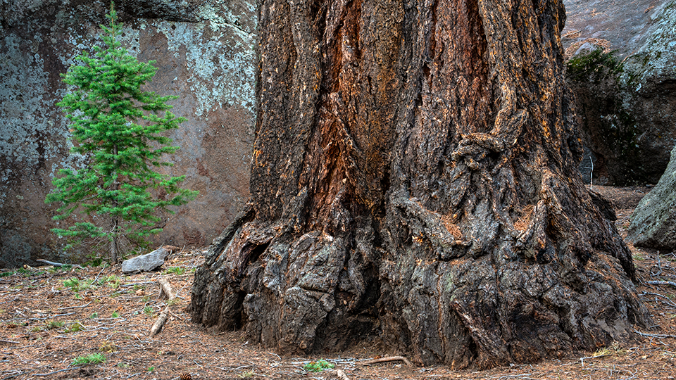
Just beyond the wilderness boundary, you’ll arrive at a grassy opening surrounded by aspens. A few strides later, you’ll encounter one of the biggest Douglas firs in Arizona. And it’s not alone. There are more big trees on this trail than almost anywhere else in Arizona. From there, the route crosses a few small side canyons and arrives at the top of a high lava cliff. It’s been ages (600,000 years) since the eruption, but there are plenty of remnants. Trees push their way through huge andesite boulders, and a dramatic, cave-like recess in the lava marks where a bed of looser volcanic debris eroded away from the denser flow layers above.
As you descend the lava wall, you’ll wind into another side canyon, the biggest of the bunch. Once you climb out, the forest opens up enough to get a good look at the summits to the left — the Kachina Trail follows the south-facing slopes of Agassiz and Fremont peaks. The viewpoint marks a spot where the trail levels off a little. From there, it moves up and down through the ancient forest, and after about 15 minutes, it climbs to a ridge on the edge of a grassy hillside. More ferns and more lupines add texture and color.
Below the ridge, the trail transitions from the old-growth thickets above to an open area of mostly meadows and ponderosas. Aspens are part of the mix, too. They’re the common denominators of this hike.
For the next 30 minutes, the trail skirts the southern edge of the grassy slope. It’s a good place to see elk. If you don’t see any, you might hear a few. The bugling of the bulls is a familiar sound during mating season.
Ninety minutes into the hike, the trail leaves the woods and spills into an open grassland. Look left, make a photo of the Peaks and continue downhill. Before long, the ubiquitous aspens will begin dotting the landscape, along with a few spruce and more giant ferns. Then, you’ll slip back into the woods, pass a tremendous ponderosa and arrive at the eastern border of the wilderness area, which butts up against Freidlein Prairie Road. Turn left and follow the narrow dirt road for about five minutes to its intersection with the Weatherford Trail, the turnaround point for this hike.
When you get there, you’ll get a good look at the Peaks to the north, and with enough glass, you might even see a few peak-baggers clawing their way to the top. You’ll respect them, but you won’t envy them. Other than altitude, the Kachina Trail has as much to offer as Humphreys, especially if you appreciate the beauty of quaking aspens.
Length: 10 miles round-trip
Difficulty: Moderate
Elevation: 9,315 to 8,869 feet
Trailhead GPS: N 35˚19.617', W 111˚42.686'
Directions: From Flagstaff, go north on U.S. Route 180 for 7 miles to Forest Road 516 (Snowbowl Road). Turn right onto FR 516 and continue 6.3 miles to the parking lot, on the right. The trailhead is at the far end of the lot.
Vehicle requirements: None
Dogs allowed: Yes
Horses allowed: Yes, but it’s strenuous for horses.
USGS map: Humphreys Peak
Information: Flagstaff Ranger District, 928-526-0866 or www.fs.usda.gov/coconino