
Water. That’s the payoff on this hike. But only because water is so rare on desert trails. Even without water, this would be a keeper. The saguaros and ocotillos and converging canyons make it so. Nevertheless, there is water, in the form of Sabino Creek, which nourishes a riparian habitat of trees that includes Arizona sycamores, ash, cottonwoods, walnuts, alders, alligator junipers and cypresses. There are wildflowers, too. And grasses. And just about every other plant the Sonoran Desert has to offer. All of which adds up to one of the best hikes in Arizona, especially in the spring, when the goldpoppies and lupines are in bloom. However, before you can hit the trail, you’ll have to catch a tram at the Sabino Canyon Recreation Area.
The recreation area is ground zero for several hiking trails in the Coronado National Forest, as well as the scenic tram tour ($15) that takes hikers and sightseers into Sabino Canyon. The quickest way to get to the Sabino Canyon Trailhead is on the tram. If you have the time, the Phoneline Trail can be used as a connecting route, but it adds 8 miles (round-trip) to the hike. Besides, if you take the tram, you’ll learn a few things about the area. For example, you’ll learn that the scenic road into the canyon was built by the Civilian Conservation Corps in the 1930s. The plan was to carve a route all the way to Mount Lemmon, but after 4 miles, the project ran out of steam. Today, the end of the road is the beginning of the Sabino Canyon Trail.
The hike starts out with a series of moderate switchbacks. It’s a well-worn path that’s easy to follow. After a few zigs and zags, you’ll intersect the Phoneline Trail. Stay left and continue north along the eastern slope of Sabino Canyon. A few minutes later, the trail levels off and points toward the dramatic Santa Catalina front range, which is known for its deep canyons and soaring ridges. From down below, you’ll hear the sounds of Sabino Creek. And all around is the Pusch Ridge Wilderness, which protects 56,933 acres of Mother Nature’s best work.
A half-hour in, the trail winds around a corner and veers away from the water. In the distance, to the north, you can just make out the big trees that blanket the higher elevations of the Santa Catalina Mountains. Binoculars help. Back at eye level, you’ll notice that the saguaros that were so prominent early on have tapered off, giving way to native grasses and Mexican blue oaks. Things remain the same for the next 15 minutes, until the trail climbs to a rocky, vegetated saddle. The views from this point are superb. From the saddle, the trail heads downhill toward Box Camp Canyon, where it intersects the East Fork and West Fork trails. The route to the east leads to Bear Canyon. The route to the west continues up Sabino Canyon to Hutch’s Pool, Romero Pass and points beyond. For this listing, veer left on the West Fork Trail.
Like most riparian crossings, this intersection can get a little tricky. It’s wide, and there’s a lot of detritus from the flood of 2006. Since then, however, cairns have sprung up, and until there’s another big flood, the route should be well marked. You’ll make your first creek crossing a few minutes later. On the other side, you’ll wind in and out of the riparian area and end up on a grassy, south-facing slope.
This is the second-best part of the trail. It’s the homestretch, and in the spring, things should be lush and green. As you head west, you’ll pass an especially impressive oak as the trail edges closer to the creek. Then, after 20 minutes, you’ll be at the water. The creek at this crossing is cluttered with large boulders, which make it hard to see where you’re going. But, again, there should be cairns to help you along. Keep in mind, you might get your feet wet.
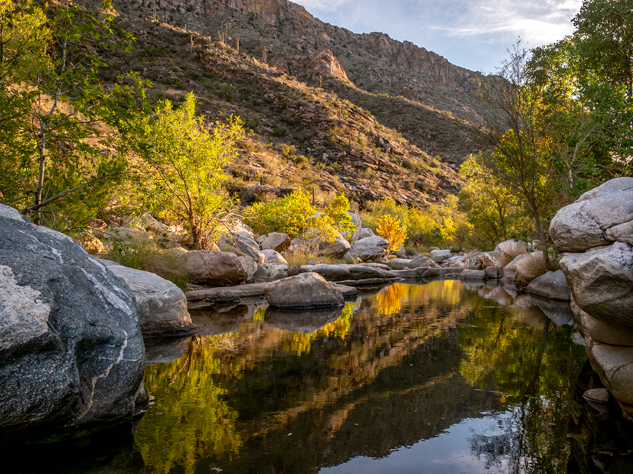
Once you make your way across, you’ll climb the other bank and, after 10 minutes, come to a large tree that nearly blocks the trail. Just before the tree, look to the right for a small side trail that leads down to Hutch’s Pool, the turnaround point for this hike. The pool is one of the highlights of the Sonoran Desert. It’s unexpected and spectacular. And it’s the payoff on a trail that doesn’t really need one.
Trail guide
Length: 7.8 miles round-trip (to Hutch’s Pool)
Difficulty: Moderate
Elevation: 3,316 to 3,769 feet
Trailhead GPS: N 32˚20.627', W 110˚46.830'
Directions: From Tucson, go east on Tanque Verde Road to Sabino Canyon Road. Turn left onto Sabino Canyon Road and continue 4 miles to the Sabino Canyon Recreation Area visitors center, which is open from 8 a.m. to 4:30 p.m. daily.
Special Consideration: An $8 day pass is required.
Vehicle Requirements: None
Dogs Allowed: No
Horses Allowed: Yes
USGS Map: Sabino Canyon
Information: Santa Catalina Ranger District, 520-749-8700 or fs.usda.gov/coronado