
Canyon de Chelly National Monument, Navajo Nation
The Navajo Nation is big. Really big. At more than 27,000 square miles, it’s the largest of all tribal lands in the United States, and it includes parts of Arizona, New Mexico and Utah. Since it’s such a big place, traveling through it often requires a lot of driving, and the 102-mile trip from Lupton to Chinle is no exception. But don’t be intimidated: You can do most of this drive at highway speeds, and the dramatic views and culture along the way are worth the extra miles on your odometer.
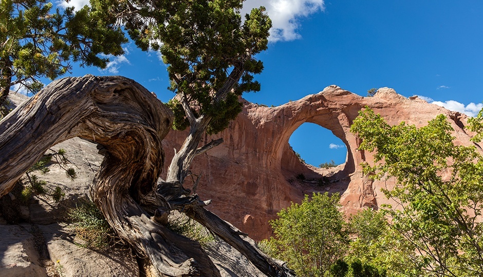
From Lupton, the easternmost populated place on Arizona’s stretch of Interstate 40 (and Historic Route 66), head north on Indian Route 12 along the Defiance Plateau. Navajo homes and farms dot the grassland here, and soon, you’ll pass the first of many red-rock buttes. Not long after, you’ll go through the small city of Window Rock, the Navajo Nation’s capital. The city’s namesake, a natural arch that’s part of Window Rock Navajo Tribal Park, is visible just north of town, to the east of IR 12.
Continuing north, sandstone buttes line the road, which crosses into New Mexico for part of the route. Before long, you’ll gain elevation and see ponderosa pines begin to replace the grassland vegetation. Up ahead are the twin Sonsela Buttes, the highest of which reaches an elevation of 8,888 feet. Beyond the buttes are the Falling Iron Cliffs, a striking formation where evergreens surround sheer cliffs of bare gray rock.
Not long after you pass Wheatfields Lake, a popular fishing destination, you’ll reach an intersection with Indian Route 64 in Tsaile, the location of Diné College. Formerly known as Navajo Community College, the school, which opened in 1968, is the oldest tribally controlled community college in the U.S.
From here, head west on IR 64, which curves to the southwest and skirts the north rim of Canyon de Chelly National Monument, which is free to visit. Several turnoffs lead to overlooks into Canyon del Muerto, and from them, you can see the Ancestral Puebloan ruins that the monument protects, along with the Navajo houses and farms still in use on the canyon’s floor. Arizona Highways has published many photos of Canyon del Muerto over the years, but for vistas this big, only an in-person experience will truly suffice.
From the overlooks, it’s just a short drive farther to the monument’s visitors center and the town of Chinle, which marks the conclusion of this drive. Of course, at this point, you’ve seen only the northern tributary of Canyon de Chelly. If you’ve got some time, head southeast on Indian Route 7 to check out the monument’s namesake canyon. But be prepared for a little more driving. Like many things on the Navajo Nation, Canyon de Chelly is … well, you get the idea.
Note: Mileages are approximate.
Length: 102 miles one way
Directions: From Interstate 40 near Lupton, take Exit 357 and go north on Indian Route 12 for 24 miles to State Route 264. Turn right (east) onto SR 264 and continue 2 miles to another intersection with IR 12. Turn left (north) onto IR 12 and continue 5 miles to an intersection with Indian Route 7. Turn right to stay on IR 12 and continue 47 miles to Indian Route 64. Turn left (west) onto IR 64 and continue 24 miles to the Canyon de Chelly National Monument visitors center.
Vehicle requirements: None
Information: Navajo Parks & Recreation, www.navajonationparks.org; Canyon de Chelly National Monument, 928-674-5500 or www.nps.gov/cach