
How have I missed this all these years? That’s what you’ll think within the first 71 seconds of hiking the Brins Mesa Trail. Not only because of the surrounding beauty, but also because it’s so easy to get to. For a few lucky Sedonans, one of the trailheads is right out the back door. For everyone else, it’s just a few blocks from the pink jeeps and turquoise jewelers.
Before you get started, you should know there are two established trailheads for this hike. The most accessible is the Jim Thompson Trailhead — the one that’s so close to the strip. The alternative is out on Vultee Arch Road. If your SUV has wings or extremely high clearance, that trailhead is an option. Otherwise, take the easy route. You can navigate it with a Mini Cooper, and the hike is equally impressive from either end.
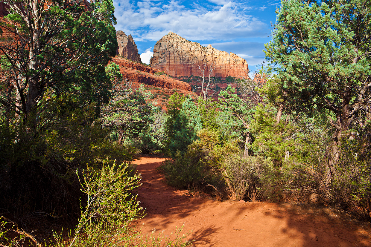
From the parking lot on the Thompson side, the trail hops up and over a small embankment and immediately passes two other trails (Jordan and Cibola Pass). The intersection is well marked. Keep right for Brins Mesa, which begins as an easy walk through manzanitas and junipers. Sedona red is all around, without any signs of civilization. Even the traffic noise disappears. It’s a lovely loneliness.
The trail points north at this point, and after about five minutes, it crosses into the Red Rock-Secret Mountain Wilderness, which is home to black bears, mountain lions, ringtails, badgers and bobcats. There are certain responsibilities that come with hiking in wilderness areas, including the principles of Leave No Trace. Please be responsible. A little farther up the trail, you’ll see what happens when you’re not.
The trail stays about the same — colorful rocks and sturdy trees — for the next 20 minutes. That’s when the hike heads west and launches into the only significant ascent. There aren’t any switchbacks. Just a natural rock staircase that winds upward. Along the way, there are several points that invite you to stop, turn around and look around. Do so. Sometimes the best views are in the rear-view mirror.
Ten minutes later, you’ll arrive on the mesa and see the effects of irresponsibility. The Brins Fire, which scorched 4,000 acres on and around the mesa, was ignited by an illegal, unattended campfire on June 18, 2006. Most of the trees on the mesa were lost, and their descendants won’t be back for many decades. It’s unfortunate. That said, the grass that moved in makes a gorgeous placeholder, especially in the morning. In the warmer months, when the daytime highs are still high, that’s when you’ll want to hike Brins Mesa. Also, if you can time your arrival to see the sunrise from up on the mesa ... well, it’s very beautiful.
From the top, the literal high point of the hike (5,099 feet), you’ll begin a gradual descent that offers long views in every direction. You’ll see Soldier Pass to the left, and up ahead, more trees — the fire line is obvious.
At the 50-minute mark, you’ll intersect the Soldier Pass Trail and begin a steep drop. It’s short, about 100 yards, and when the trail hits the bottom, it leaves the wilderness area and enters a good-sized wash. The forest is thicker down there, and some of the trees are unexpectedly big. One of the biggest isn’t around anymore, but the stump that remains can attest to the tree’s Bunyanesque heyday.
Just beyond the big stump, the trail crosses the wash, crosses again, and crosses once more before arriving at a large, flat rock, about the size of a Whole Foods’ produce department. The trail then parallels the wash, going back and forth for most of the rest of the hike — beware of flash floods, especially during the rainy season.
A few minutes later, you’ll pass through a fence and begin the 200-yard homestretch to the trailhead on Vultee Arch Road. You probably won’t see anyone when you get there, but if you do, it’s a good bet their SUV has extremely high clearance. Or maybe a set of wings.
Trail guide
Length: 6.4 miles round-trip
Difficulty: Moderate
Elevation: 4,503 to 5,099 feet
Trailhead GPS: N 34˚53.286', W 111˚46.097'
Directions: From the roundabout intersection of State Route 179 and State Route 89A in Sedona, go north on SR 89A for 0.2 miles to Jordan Road. Turn left onto Jordan Road and continue 0.7 miles to Park Ridge Drive. Turn left onto Park Ridge Drive and continue 0.1 miles to where the pavement ends. From there, continue 0.5 miles on the dirt road that leads to the Jim Thompson Trailhead.
Special Consideration: A $5 day pass is required.
Vehicle Requirements: None (at the Jim Thompson Trailhead)
Dogs Allowed: Yes (on a leash)
Horses Allowed: Yes
USGS Map: Wilson Mountain
Information: Red Rock Ranger District, 928-203-2900 or fs.usda.gov/coconino